
This post contains affiliate links. If you buy something through these links, I may earn a small commission at no extra cost to you. I only recommend gear I’ve actually used out on the trails and really loved! Read my full disclaimer.
The Scenic Rim is on Mununjali, Yugambeh and Ugarapul Country. I acknowledge the Traditional Custodians of this area and their connection to Country, and pay my respects to their Elders past and present.
Southeast Queensland has no shortage of scenic country drives.
You can head into the Gold Coast Hinterland, take the Lion’s Road into New South Wales, or skirt around the Glass House Mountains and the Blackall Ranges on the Sunshine Coast.
My favourites are the ones that take you slightly off-track—ideally with a quiet picnic spot and a waterfall or two. Tourist Drive #21—the Waterfalls Drive—offers exactly that.
But for the best scenery in this corner of the Southern Downs, you have to go beyond the sealed road.
The Condamine River Road swaps the paved roads for 14 river crossings and a much slower pace through the headwaters of the river.

It’s isn’t a technical 4WD challenge per se; for me, it’s more about the gorge, the river gums and enjoying the drive.
Trip At a Glance
HOW TO PLAN YOUR CONDAMINE LOOP
With four waterfalls, several scenic lookouts and plenty of picnic spots, this volcanic border region between Queensland and New South Wales is made for a leisurely day trip.
I’ll admit that despite living in Southeast Queensland, I didn’t realise the full extent of this drive until we stumbled upon it many years ago. We originally set out just to explore Queen Mary Falls, but then realised there was a lot more to it.
The best way to experience this area is as a circuit. By combining the sealed Falls Drive (Tourist Drive #21) with the unsealed Condamine River Road, you create a perfect loop through the Scenic Rim. You will need a high-clearance 4WD to complete the full circuit via the 14 river crossings.
Here’s how to do it.

GETTING THERE
The Falls Drive (Tourist Drive #21) is located about 140km southwest of Brisbane in the Scenic Rim. You can treat this as a simple out-and-back trip on bitumen, but the best way to do it is a loop that combines the waterfalls with the Condamine River Road.
- From Killarney: Most people start in Killarney (34 km east of Warwick). You’ll do the waterfalls first on the sealed road, then hit the 4WD section to loop back.
- From Boonah: If you’re coming from the east, you’ll climb the Teviot Range and join the loop at “The Head”. From here, you can choose to do the river crossings first or head straight to the falls.
Day Trip vs. Camping: If you are already camping in Main Range National Park, this is a great afternoon trip. You can definitely do it as a day trip from Brisbane, but you’ll easily rack up 400km, so you really have to love being behind the wheel.
A quick heads-up: This area isn’t exactly a secret. Don’t expect to have the picnic spots or lookouts to yourself, especially on a Sunday. Go mid-week and outside of school holidays if you want a bit more peace and quiet.
CAN YOU DRIVE THE CONDAMINE RIVER ROAD?
If you have a high-clearance 4WD and a bit of common sense, the answer is usually yes. This isn’t a “hardcore” track, but it’s definitely not suitable for an AWD or a standard sedan.
Most importantly, heavy rain is a big no-no. Even if it’s dry in Killarney, rain at ‘The Head’ can make crossings impassible. The road is usually closed by the council during and after significant rain anyway but use common sense (there are gates now).

VEHICLE REQUIREMENTS
You don’t need a kitted-out monster 4WD with a snorkel and crazy lift kit to do this drive in normal conditions, but you do need high clearance. The entry and exit points of the river crossings can be steep, and a low-slung car will likely scrape or get hung up.
We’ve done this drive several times in our Toyota Prado. While it has a slight lift, it’s nothing extreme. In fact, the last time we did the Condamine, I was behind the wheel. I’m only an average 4WDer at best, so if I can do it, you most likely can too.
THE 14 RIVER CROSSINGS
For a beginner or an amateur like me, the crossings are a perfect introduction to 4WDing.
- Firm base: Most of the crossings have a solid, rocky base. Some even have concrete bases now. You aren’t likely to get bogged in deep mud here; you’ll just wobble over the river stones, which is quite fun!
- The “first crossing” rule: The first crossing (if you’re coming from the Killarney side) is usually a great indicator of the rest. If you feel comfortable with the depth and the entry there, you’ll probably be fine for the other 13.
- Speed: Keep it slow and steady. There’s a 30 km/h limit on the road for a reason—it’s better for your car, the riverbed and the locals.
⚠️ Check Before You Go
The 14 river crossings are prone to flash flooding and are closed by the Council after heavy rain. Always check the local Road Conditions Dashboard or the QLD Traffic map before you leave Killarney to ensure the gates are open.
THE FALLS DRIVE: WATERFALLS & LOOKOUTS
The first half of the loop follows Tourist Drive #21.
It’s a fully sealed, winding road that hugs the edge of the Main Range, offering glimpses of the rugged Scenic Rim peaks through the trees.

Even if you aren’t planning to do the river crossings, this section is worth the trip on its own. It’s essentially a tour of four distinct waterfalls, interspersed with sweeping lookouts across the range and some of the best picnic spots in the region.
The road is narrow and can be very busy with weekend day-trippers, so take your time and enjoy the “vistas”—just keep an eye out for wallabies near the road edges.
BROWN’S FALLS
Coming from Killarney, Brown’s Falls is the first stop. While it’s only a 600m return trip, it’s more of a scramble than a walk.

You’ll find a few sporadic markers in the trees but that’s about it. Instead of a graded track, you’ll be picking your way along the creek bed, over fallen trees and rock-hopping along the way. If there’s been any rain, expect it to be slippery.
It’s the “wildest” of the four falls on this drive, and because of the scramble, it can feel a bit more secluded than the others. Wear shoes, not thongs, would be my tip!
Brown’s Falls Park is also a handy spot to stop as there are public toilets and plenty of space to spread out for a picnic.

DAGG’S FALLS
Dagg’s Falls is a very quick stop just after Brown’s Falls. Unlike the other falls on this drive, there is no access to the falls themselves; instead you view the 39m drop from a roadside lookout.

My Tip: The light at the lookout was terrible in the mid-afternoon. If you want a decent photo, plan to be here in the morning instead.
QUEEN MARY FALLS
Queen Mary Falls is the obvious stop on this drive—and rightly so. It’s a 40m drop that’s quite impressive, especially after some rain.

This area is part of Main Range National Park, and you should definitely do the Queen Mary Falls Circuit here.
It’s a whopping 2km (hardly a trek but worth the effort) and combines the even shorter Cliff Circuit with two distinct lookouts.


Facilities & Food: There is no national park camping here, but there is a caravan park directly across the road. Their café was doing a roaring trade when we passed by last time—handy if you didn’t pack a lunch.
The Gondwana rainforest here is beautiful, but if you’re chasing even more waterfalls, my guides to Springbrook National Park or Lamington National Park should be your next stop.
CARR’S LOOKOUT
It is about 8km from Queen Mary Falls to Carr’s Lookout. Don’t get too caught up in the signage along the way; the distances for “scenic photo spots” seemed to shift with every sign you pass.

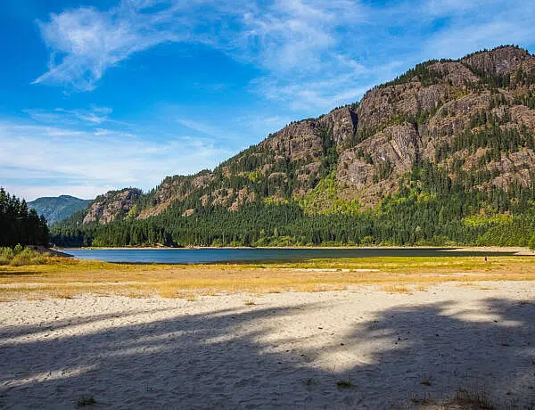
At the lookout, you get sprawling views of the undulating Head Valley and the surrounding Scenic Rim. The contrast is massive—it’s lush, green countryside compared to the bone-dry plains just over the range near Killarney.

This valley is where the headwaters of the Condamine River spring from. From here, the road becomes narrow and winding as you drop down into the valley to start the loop back.
DRIVING THE CONDAMINE RIVER ROAD
Once you reach The Head, the sealed road ends. Turn left onto the Condamine River Road to start the 18km return loop through the gorge.


There is a donations box at the southern end (near Killarney) to help with road maintenance—just like the Lion’s Road, it’s worth dropping in some spare change.
THE DRIVE
The track winds through the Cambanoora Gorge, past typical Australian bush, grazing country and some stunning volcanic cliffs.

The speed limit is 30 km/h, and because the road is gravel and crosses the river 14 times, you wouldn’t want to go much faster anyway.
THE 14 CROSSINGS
You can’t really get lost here—just follow the road through the water. The crossings are either rocky or have concrete bases but the track itself can become muddy after rain.
When you do the drive in winter or early spring (June-Aug/Sep), the crossings are shallower (unless we’ve had unseasonably heavy rain). In summer or early autumn (March/April), they can have a bit more water.
You always come across a few annoying vehicles barreling through the crossing but most drivers take it slow and steady to enjoy the splash.


Most of the 14 crossings are fairly straightforward in dry conditions.
Condamine Gear Essentials
CAMPING & LOCAL TIPS
Most of the land on either side of the road is private property.
You’ll see plenty of people set up for the day with gazebos in “typical Queensland fashion” but you can’t just pitch a tent anywhere.

Where to Camp: We have camped at a private property at the start of the road near Long Crossing (the Killarney end). There are a few private Hipcamps along the river that offer a much more off-the-grid feel than the caravan parks in town. Just keep in mind that if the river rises, you might be staying longer than planned!
At one spot further along, you can sometimes buy some local honey. Which I did, of course, I love local honey.

The Verdict: Water crossings aside, this is a pretty easy 4WD track and perfect for an amateur like me. Use common sense, time it right and you’ll be fine. Once you’ve finished the 14th crossing, the gravel turns back to bitumen and you’re only a few minutes from Killarney.
It’s the perfect spot to grab some food or a cold drink before the drive back to Brisbane or your camp spot in the Scenic Rim.
FINISHING THE LOOP: THE SUNSET DRIVE
If you aren’t doing the 4WD loop back to Killarney, you can continue north towards Boonah on Tourist Drive #21.
On the way, you’ll pass Teviot Falls. It’s not a formal lookout, it’s more of a narrow pull-out spot on a very sharp bend.
Fair warning: This spot can get chaotic. Between the narrow road and limited space, parking is often a mess, and traffic can back up a bit here as people try to squeeze in. If it looks like a circus when you arrive, it’s probably safer to keep driving—the view of the falls is quite distant anyway.
THE WAY BACK TO THE MAIN RANGE
Instead of heading all the way into Boonah, turn onto Croftby Road. Taking this back towards the Main Range turned into a fantastic sunset drive once, with the mountains on one side and open grazing country on the other.
It’s a much quieter, stress-free way to finish the day than sticking to the main highway.

Plan your next scenic drive: If you’re looking for more day trips from Brisbane, head north to the Sunshine Coast. You can explore the Blackall Range for hinterland towns and rainforests, or skirt around the Glass House Mountains for iconic peaks and pineapple plantations.
Happy exploring,

SAVE TO PINTEREST


No Comments