
Gibraltar Range and Washpool National Parks are on Bundjalung, Gumbaynggirr and Ngarrabul Country. I acknowledge the Traditional Custodians of this area and their deep and ongoing connection to Country, and pay my respects to their Elders past and present.
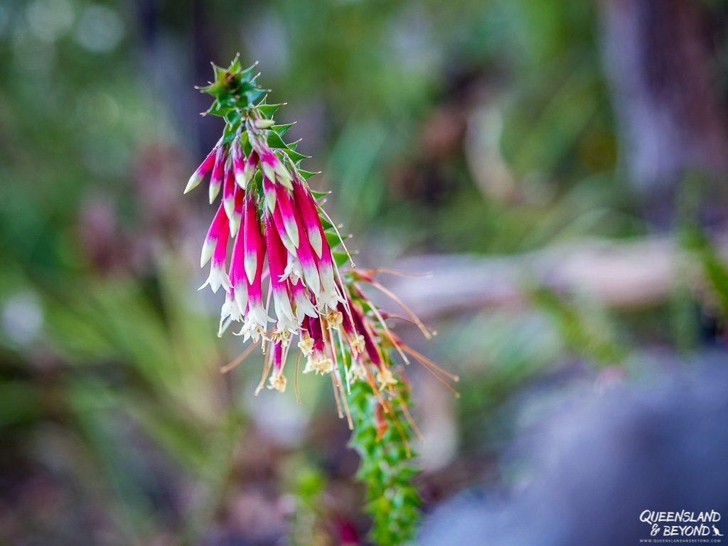
Gibraltar Range and Washpool National Parks are both part of the Gondwana Rainforests of Australia: World heritage national parks that protect thousands of special plants and animal species.
Bird life in any of the Gondwana Rainforests is usually utterly nuts! I love it.

Gibraltar Range and Washpool are separate national parks but since they’re next to each other, it makes sense to explore them both while you’re there. But if you have less time, pick one and explore away!
GIBRALTAR RANGE AND WASHPOOL NATIONAL PARKS: TIPS FOR YOUR FIRST VISIT
Gibraltar Range and Washpool are adjacent national parks and run on both sides of the Gwydir Highway between Grafton and Glen Innes.
Neither national park will probably leave you breathless you with incredible sights, rock formations, cliffs or rainforests, they are worth a few days of relaxed camping and hiking the many short trails.
The walks we did were all really enjoyable and had some good lookouts. Plus, the bird life here is terrific, and there are creeks, swimming holes and a few waterfalls to enjoy.
HOW MUCH TIME TO PLAN
Ideally, spend about 4-5 days camping here if you want to discover all Gibraltar Range and Washpool have to offer while also having some time to relax.
This gave us plenty of time to explore both Gibraltar Range and Washpool National Park, and also do the Old Grafton-Glen Innes Road scenic drive (which, admittedly, wasn’t that scenic).

HOW TO GET TO GIBRALTAR RANGE AND WASHPOOL
Gibraltar Range and Washpool are located on both sides of the Gwydir Highway in northern New South Wales. The area is about 3.5 hours southwest of Byron Bay or just over 2 hours northwest of Coffs Harbour.
From Brisbane, it’s about a 400km drive or 4.5 hours.
Coming from Queensland, take the M1/A1 (Pacific Highway) along the coast down to Grafton, which seems to take ages as most of the Pacific Highway is single-lane in NSW. From Grafton, it’s another 100km west along the Gwydir Highway.
On our way back home, we decided to go inland and avoid the never-ending roadworks along the A1. We headed towards Glen Innes and then north through Stanthorpe and Warwick on the New England Highway.
It didn’t seem much quicker but I got to eat gluten-free apple pie at Suttons north of Stanthorpe, one of our obligatory stops if we come up the New England Highway. So, happy days! 🙂

In terms of accessing the national parks, you can’t miss them from the Gwydir Highway as there are really big signs along the road.
The campgrounds and walking tracks are on gravel roads, which should be fine for 2WD vehicles. Wet conditions, of course, change things.
BEST TIME TO VISIT GIBRALTAR RANGE AND WASHPOOL
Since the national parks are at about 1,000m above sea level, camping here is still quite pleasant even over the summer.
It can still be hot during the day (low-mid 30°C) but the nights are likely to be cool. I could sleep quite easily.
If you come in the summer, just leave most of your hiking for the early morning or late afternoon, and take a swim during the day. That worked quite well for us (though it also meant that we didn’t have enough time to squeeze all the walks in).
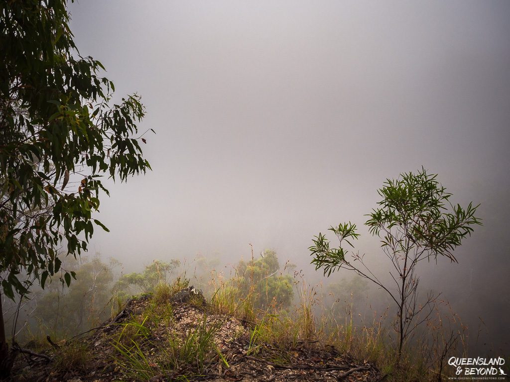
Even in summer, the ranges were foggy in the early morning but the fog dissipated by about 7:30am.
In winter, you would deal with a lot more fog and wetter conditions, not the mention much colder temperatures. It may drop to below 0°C.

March-April is probably a great time to visit as it’ll be cool enough to do all the walks during the day but not yet so cold that you’ll freeze some part of your body off.
WHERE TO STAY AT GIBRALTAR RANGE AND WASHPOOL
CAMPING AT GIBRALTAR RANGE AND WASHPOOL
We spent four nights camping at Mulligans Campground in Gibraltar Range, which is a rare treat with inviting Dandahra Creek and a swimming hole nearby.
There are four camping areas across both national parks, some nicer than others.
In addition to pre-booking your site and paying the camping fees, you also need to pay a daily parks entry fee ($8 per vehicle). If you camp there for a few days, it’s actually cheaper to get an annual NSW Parks pass. The Country Parks Pass covers all parks in NSW where you have to pay entry fees (except for Kosciuszko), and is the one we always buy.

We stayed at Mulligans Campground in Gibraltar Range National Park, and thoroughly enjoyed having our own site. Mulligans has flush toilets and showers.
The camping areas in Washpool National Park only offer drop toilets but also tend to have fewer people.
Remember to camp responsibly.
HUT ACCOMMODATION
If you don’t want to camp, NSW Parks & Wildlife operate two huts in the national parks.
Gibraltar House at Gibraltar Range offers accommodation for up to 10 people while Four Bull Hut in Washpool National Park has space for six people.
Gibraltar House is directly along the Gwydir Highway and the NSW Park’s equipment depot appears to be right behind the hut. But… it looks cozy enough and is probably a great option for a winter escape!
Four Bull Hut is a bit more tucked away.
CULTURAL HERITAGE: MULLIGANS HUT
This area is the traditional home of the Bundjalung, Gumbaynggirr and Ngoorabul peoples. There are also remnants of early settler history.
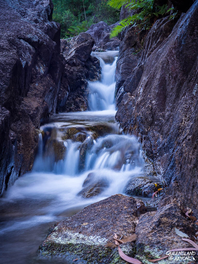
Mulligans Hut near Mulligans Campground bears witness to a time when early entrepreneur Bill Mulligan was keen to build a hydro-electric scheme at the beginning of the 20th century.

The weir structure at Murrumbooee Cascades and also at the swimming hole at Dandahra Creek were built to promote the scheme but which ultimately never took off.
5 SHORT WALKING TRAILS IN GIBRALTAR RANGE AND WASHPOOL NATIONAL PARKS
Most of the walking trails in Gibraltar Range are on Mulligans Drive, which also leads to Mulligans Campground and Picnic Area.
There are also a couple of short walks near the Boundary Falls Campground on the north side of the Gwydir Highway.
Take Coachwood Drive (off the Gwydir Highway) to get to the walks in Washpool National Park.
1. MURRUMBOOEE CASCADES TRACK | GIBRALTAR RANGE
BASIC TRAIL INFO

DISTANCE: 6km return with some elevation gain (on the return)
GRADE: 4 (moderate)
TIME: 2.5 hours
TRAILHEAD: Mulligans Hut (Mulligans Picnic Area), Gibraltar Range NP
The Murrumbooee Cascades Track is a relatively easy walk to a series of cascades and remnants of a weir that date back to the 1920s.
Starting at Mulligans Hut, you’ll find the Barra Nulla Cascades some 120m after the start of the walk. We poked around for a while and then continued on to the actual destination.

The trail is initially quite flat but then meanders steadily downhill, which you really only notice once you walk back up again.
It’s a good walk to do on a warm day as most of the walk is through rainforest so there’s plenty of shade. It’s not particularly pretty rainforest but we could hear lots of whip birds along the way.

We probably spent a good half hour scrambling around the creek bed at the end, exploring the cascades and the old weir.


All in all it took us about 2.5 hours to do the 6km return walk but includes almost an hour hanging around the Murrumbooee Cascades spot.

2. THE NEEDLES TRACK | GIBRALTAR RANGE
BASIC TRAIL INFO

DISTANCE: 6km return with some elevation gain
GRADE: 3 (easy-moderate)
TIME: 2.5 hours
TRAILHEAD: Mulligans Hut (Mulligans Picnic Area), Gibraltar Range NP
Like the Murrumbooee Cascades Track, The Needles Track starts at Mulligans Hut past the picnic area but at the opposite end.
Cross the little bridge across Dandahra Creek and follow the wide track until you get to a T-junction. Turn right and from there the trail will get narrower before climbing up a bit.
Eventually you’ll get to a rocky outcrop from where you can see granite columns, The Needles, rising in the distance.

Most of the walk is shady and either through dry forest or rainforest, making this a good option when it’s a bit warmer and sunny.


There are no views along the way and we found the track itself rather boring but the views at the end make up for it.

You could combine this walk with the Tree Fern Forest Walk, which would mean a 12km hike altogether. We left late in the afternoon (since it was hot) so didn’t have time (or the inclination) to do a longer loop. Others we met said that the Fern Tree Forest Walk is quite exposed and not a great option for a hot day.
3. LYREBIRD FALLS TRACK | GIBRALTAR RANGE
BASIC TRAIL INFO

DISTANCE: 2.2km return
GRADE: 4 (easy-moderate)
TIME: 1.5 hours
TRAILHEAD: Boundary Falls Picnic Area, Gibraltar Range NP
To do the Lyrebird Falls Track from Mulligans Campground, you’ll need to drive to the Boundary Falls picnic area on the north side of Gibraltar Range National Park.
We did this walk the day we left Gibraltar as we were going via Glen Innes anyway and Boundary Falls is on the way.
In nutshell, it’s an easy walk along wide track to a lookout point into a valley and Lyrebird Falls.

At the height of summer, the waterfall wasn’t gushing but a mere trickle, and the views themselves were rather limiting.
We actually did this walk twice, on the same day, as the entire valley was shrouded in fog on our first attempt at 6:30am. An hour later, we had clear blue skies but still obstructed views because of vegetation.
But even without the trees in the way, the views wouldn’t be breathtaking (according to NSW Parks & Wildlife they are…).

Plus, you can only make Lyrebird Falls out in the distance.
On the positive side, we did actually see lyrebirds crouching around the underbrush. Definitely more exciting than the views at the end.
4. BOUNDARY FALLS WALK | GIBRALTAR RANGE
BASIC TRAIL INFO

DISTANCE: 0.4km return with some elevation gain
GRADE: Moderate (because of stairs)
TIME: 0.5 hour
TRAILHEAD: Boundary Falls Picnic Area, Gibraltar Range NP
The walk to Boundary Falls starts from the same picnic area as the track to Lyrebird Falls.
It’s a really short walk down some steps to a small rock pool and, in summer, trickling Boundary Falls. If you’re already at the picnic area, it’s probably worth checking out. Otherwise, I’d say you’re not missing much.

5. WASHPOOL WALK TRACK | WASHPOOL
BASIC TRAIL INFO

DISTANCE: 8.5km loop with some elevation gain
GRADE: 4 (moderate)
TIME: 3-3.5 hours
TRAILHEAD: Coombadjha Campground, Washpool NP
Aside from Murrumbooee Cascades, the Washpool Walk was the other walk I really enjoyed.
This track is in Washpool National Park at the end of Coachwood Drive. It’s easy to find, just park at the tiny Coombadjha car park.
The hike starts along Cedar Creek and then climbs up out of the rainforest and into dry sclerophyll forest.
From there you meander through forest (with more incline than I had expected) and eventually drop down to Coombadjha Creek, where you could go for a refreshing dip if there was enough water.

Definitely take the detour to Summit Falls, they’re quite pretty.
FURTHER WALKS IN THE NATIONAL PARKS
Since we camped at Gibraltar Range during mid-January, temperatures were in the low to mid-30s during the day.
I don’t deal well heat so we didn’t tick off all the walks as we’re known to do. Instead, we lounged around during the day, went swimming in nearby Dandahra Creek, and stuck to early morning or late afternoons for hiking.
But if you’re there at a different time of the year or don’t mind the heat so much, here are a few other walks you could do. NSW Parks & Wildlife have also created a few new walks since our last visit – yay, more to explore next time!
MORE GIBRALTAR RANGE WALKING OPTIONS
MULLIGANS HUT AREA
- Forest Walking Track – new track (easy 3.5km return, 1.5 hours; from Mulligans Hut Picnic Area) – a short track through the rainforest along Little Dandahra Creek
- Tree Fern Forest Track (easy-moderate 9.2km loop, 3-3.5 hours; from Mulligans Hut Picnic Area) – relatively exposed and could be combined with The Needles Track
- Dandahra Falls Track (hard 5km return, 3.5 hours; from Mulligans Hut Picnic Area) – steep track to a waterfall, closed when we were there or we may have attempted it
- Little Dandahra Creek Track (easy-moderate 13km return, 3.5-4.5 hours; from Mulligans Hut Picnic Area) – an easy walk along the Little Dandahra Creek ending at Gibraltar Hut along the Gwydir Highway
- Junction Spur Track – new track (hard 8km return, 5 hours; from Mulligans Hut Picnic Area) – a more challenging (unmarked) track following a spur between Little Dandahra Creek and Dandahra Creek
- Anvil Rock Track (easy-moderate 4km return, 1.5 hours; off Mulligans Drive) – could be combined with Dandahra Crags Track to make a bigger loop
- Dandahra Crags Track (moderate 7.1km return, 2.5 hours; off Mulligans Drive) – I’ve since seen photos and this walk looks rather spectacular with its rock formations at the end so I’d definitely add that to my list for next time; could be combined with Anvil Rock since they both start from the same trailhead
BOUNDARY CREEK AREA
- Duffer Falls Track (moderate 7km return, 3 hours; from Boundary Creek Picnic Area, along the overnight hike) – to a lookout where the small Duffer Falls cascade over the cliff
MORE WASHPOOL WALKING OPTIONS
- Coombadjha Nature Track (easy 0.8km loop; from Coombadjha Campground or Coachwood Picnic Area) – if you don’t want to do the Washpool Circuit, this is a short loop to a small swimming hole that takes you along Coombadjha Creek
- World Heritage Walk (moderate 45km circuit, 3-5 days) – overnight hike that loops through Washpool and Gibraltar Range, includes a mix of road, management tracks and walking trails

LOOKOUTS IN GIBRALTAR RANGE AND WASHPOOL
If you’ve done enough hiking, there are also a few lookouts to enjoy where there’s almost no walking involved.
RASPBERRY LOOKOUT
I quite enjoyed Raspberry Lookout, which is along the Gwydir Highway towards Glen Innes (not far from the Gibraltar Range National Park boundary). You don’t even need to get out of your car but obviously the views are nicer if you do.

GRANITE LOOKOUT (0.8KM RETURN)
Granite Lookout (at 1,065m) is in Washpool National Park.
The trailhead is at the Granite Picnic Area, just off the Gwydir Highway. It’s a quick 400m walk to a rocky outcrop and a happily situated bench from where you can enjoy the views into the valley.


I expect you also have great views from Dandahra Crags and Anvil Rock since they’re both at over 1,000m.
FINAL THOUGHTS
Mulligans Campground at Gibraltar Range is easily one of my favourite spots for a summer camping break. Though hot, it was peaceful and relaxing, and the bird life in the morning was terrific. The swimming hole here is gorgeous and inviting enough even for me.
There are plenty of short and longer walks that suit all fitness levels. I only wish we’d had an extra day so that we could have hiked out to Dandahra Crags and Anvil Rock.
The main challenge at Gibraltar Range and Washpool really is to work out where you want to camp and where exactly the walks are that you want to do. Ideally, spend 4-5 days at Gibraltar Range and/or Washpool so that you can explore the various parts of both national parks.
Happy exploring,

MORE INFORMATION
For more details, including current alerts and park closures due to bush fires or other weather conditions, check NSW Parks & Wildlife resources on Gibraltar Range National Park and Washpool National Park.
Check out the map below for more details on the locations for the camping areas and hiking trails.
MORE POSTS ON GIBRALTAR RANGE AND WASHPOOL NATIONAL PARKS
I’ve got more details and photos of the Washpool Walk (8.5km) in Washpool National Park here. And if you can’t decide where to camp, here’s my overview of the different camping options in both national parks.
SAVE TO PINTEREST


No Comments