
This post contains affiliate links. If you buy something through these links, I may earn a small commission at no extra cost to you. I only recommend gear I’ve actually used out on the trails and really loved! Read my full disclaimer.
Many of these hikes are on Aboriginal Country. I acknowledge the respective Traditional Custodians of these areas and their connection to land, sea and community. I pay my respects to their Elders past and present.
Almost every time we’re out hiking, the husband and I end up in the same circular conversation about our “all-time” most epic hikes.
We’ve got lists for everything: the Top 10, the Top 30, and a fairly extensive “worst hikes ever” list (which usually involves too much bush, no views and far too much vehicle management track walking).
Since we’re clearly not getting any younger and our memories are starting to fade, I figured I’d better actually write the Aussie day hike rankings down before we forget which ones were actually good.

WHAT ACTUALLY MAKES A TRAIL WORTHWHILE?
For a hike to get into our personal Top 10, the trail itself must be scenic—at least in parts. We’re not big fans of a boring 10km vehicle management track just to see one nice view at the end; the whole walk needs to have something on offer.
The husband grew up in the Aussie bush and has done way more kilometres than me. He’s also notoriously hard to impress, so if he actually says a trail is “not bad”, it’s most likely a proper standout.
I’ve decided to keep this list strictly to day walks. They’re not all around the corner from major cities and you won’t do them in a weekend away. But these are the 10 walks across the country that we’d actually go back to and do again.
1. CARNARVON GORGE | CARNARVON NATIONAL PARK (QLD)
CARNARVON GORGE AT A GLANCE
Carnarvon Gorge sits in the heart of Queensland’s sandstone belt, and while there are plenty of lookouts, the main gorge track is an absolute standout.

It’s a 10km walk (one-way!) to Big Bend, and can be done in a day, but unless you’re 20 and have endless stamina (which I haven’t), it’s a pretty big day. There are lots of gorgeous side trips along the way but luckily, most of the trail is pretty flat.
The scenery itself is just beautiful as you wind past towering sandstone cliffs, Carnarvon fan palms, and cross Carnarvon Creek several times.
Ideally, spend a few days at Carnarvon Gorge, and if you want to see all the side trips (the moss garden, rock art sites and narrow canyons), do it as an overnighter. There’s a small camping area at Big Bend—waking up in the gorge the next morning is pretty special.
2. VALLEY OF THE WINDS | ULURU-KATA TJUTA NATIONAL PARK (NT)
VALLEY OF THE WINDS AT A GLANCE
Most people only look at the Kata Tjuta domes when they change their gorgeous colour at sunset. But if you actually take the 45-minute drive from Yulara, you’ll find (slightly more) solitude here than at the sunset spot!

The Valley of the Winds Circuit is a fantastic way to see these beautiful domes up close, though the walk isn’t a casual stroll. There are some steep, rocky sections and there’s virtually no shade.
The climb up to Karu Lookout is only about 1km from the start but it might raise your heart rate just a tad. Karingana Lookout is even better, though—standing between the massive domes is pretty special.
Just keep in mind that the heat out here is no joke. Parks Australia closes the trail past the first lookout once it hits 36°C at 11am. If you aren’t starting early (even in winter!), you’re doing it wrong. Heat stress is a serious risk on these desert tracks so pack plenty of water, wear decent shoes, and don’t expect much reception once you’re inside the domes.
3. COASTAL TRACK | CAPE LE GRAND NATIONAL PARK (WA)
COASTAL TRACK (LUCKY BAY TO HELLFIRE BAY) AT A GLANCE
While Lucky Bay is famous for its incredibly white sand and stunning blue water, the Coastal Track gives you a real taste of what Cape Le Grand is all about.

The section from Lucky Bay to Hellfire Bay is easily the most scenic part of the entire 15km one-way track. It takes you across Thistle Cove and over some pretty rugged granite headlands with views of that ridiculously clear turquoise water along the way.
It’s exposed and a bit raw, and your only track guides are markers drilled into the granite outcrops—there are plenty of them, you can’t really get lost.
If you don’t like heights, the “track” can feel a bit dicey at times, especially that last climb across a steep granite rockface. But when you see Hellfire Bay for the first time (even in bad weather), you’ll forget all about it (until you have to head back 😆).
Just don’t attempt it in the rain; when the granite gets wet, it becomes seriously slippery and dangerous.
4. TARN SHELF CIRCUIT | MOUNT FIELD NATIONAL PARK (TAS)
TARN SHELF AT A GLANCE
Back in 2011, we hiked the 12km Tarn Shelf Circuit in Mt Field. It’s so close to Hobart that it’s an easy day trip, and to this day, it remains one of my most cherished hikes. The scenery is simply breathtaking.

Once you hit the treeline, you follow a series of small mountain lakes (tarns) past snow gums, fanning pandanus, and a few alpine huts. There’s a fair bit of boardwalks and some light rock hopping, and the panoramic views across the tarn shelf and into the valleys beyond are stunning.
Especially the first half of this walk is significantly more beautiful than my old photo might suggest! 🙂
5. MITCHELL FALLS (PUNAMII UNPUU) | MITCHELL RIVER NATIONAL PARK (WA)
MITCHELL FALLS AT A GLANCE
It’s a bit of a trek to get to Mitchell Falls—the road is definitely rough—but it is one of the most ruggedly beautiful spots in the Kimberley.

The hike to the falls isn’t a walk in the park. While a lot of people opt for the helicopter ride back to avoid the midday sun, we did the full slog and hiked both ways. If you start at sunrise, it’s definitely doable.
Keep your eyes peeled for some Gwion Gwion rock art along the way; it’s fascinating but you won’t spot it if you’re just staring at your boots. There isn’t too much rock hopping, but you will have to get your feet wet right at the end to cross the Mitchell River.
Like with hikes in the NT, heat stress is a real concern here so be smart: Start early, drink lots of water and seek shade when you can. You can go for a swim in the pools at the top of the falls—just make sure you’re sufficiently upstream. It’s a fantastic way to cool down before you turn around and face the walk back down.
6. ORMISTON POUND | TJORITJA NATIONAL PARK (NT)
ORMISTON POUND WALK AT A GLANCE
It’s incredible how diverse Australia is—from the alpine areas of Tasmania and NSW to the rainforests of Queensland and the rugged coast of Victoria. But for me, the sunburnt country of the Northern Territory is the spot that keeps surprising me!

The half-day Ormiston Pound Walk is easily one of our top 10 hikes in the country. Whether you go anti-clockwise (which I’d recommend) or clockwise, the scenery is spectacular. You make your way through the vast, ancient crater that is the Ormiston Pound before heading into the towering red cliffs of the gorge itself.
The vistas here are on a grand, timeless scale. They always give me a bit of perspective and help me feel more in tune with my faith—nature has a way of making you ponder life on a much larger scale.
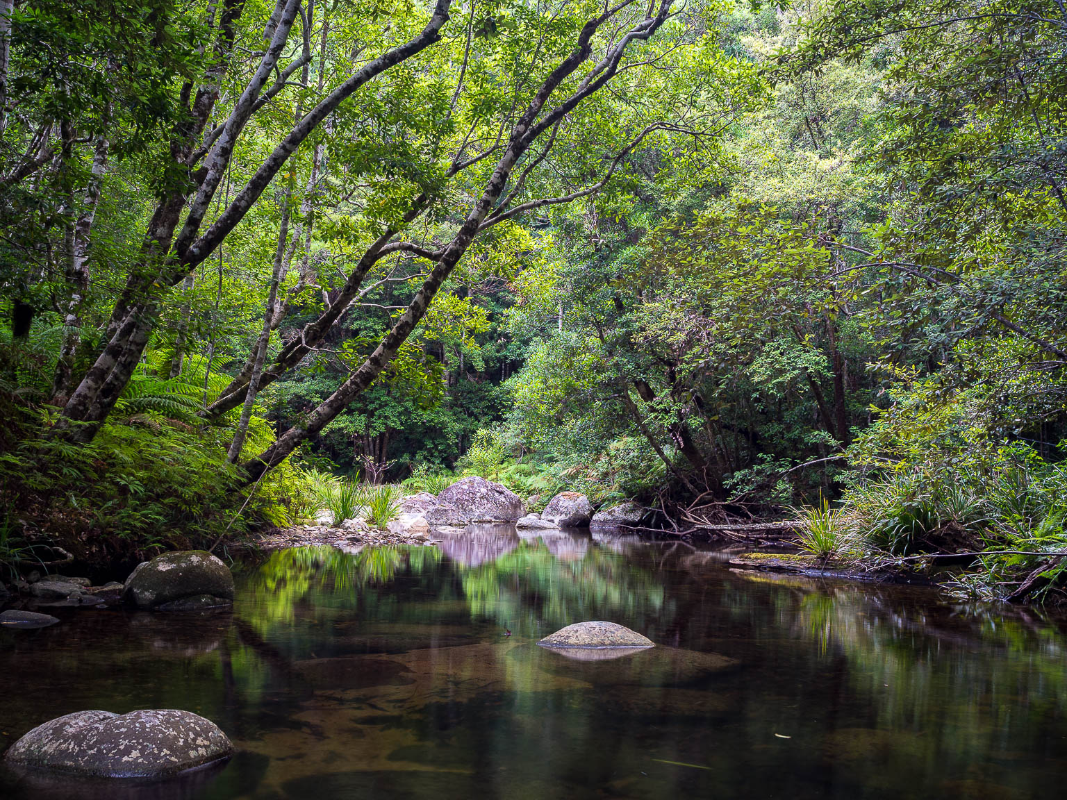
7. COOMERA CIRCUIT | LAMINGTON NATIONAL PARK (QLD)
COOMERA CIRCUIT AT A GLANCE
Lamington is one of our favourite places in Southeast Queensland. There are heaps of hiking trails to choose from, but the Coomera Circuit remains a standout.

It’s a beautiful rainforest walk with more waterfalls than you can really keep track of—though I have to admit, Toolona Creek is a very close second!
The track follows the Coomera River as it cascades down the plateau. Once you reach the lookout over Coomera Falls and the Yarrabilba Gorge, you get a real sense of the scale of the place. It’s lush, ancient, and feels a million miles away from the noise of the coast.
Just a bit of practical advice: This one is best saved for the cooler months. If you go when it’s wet and humid, you’ll be dealing with plenty of mud and enough leeches to test anyone’s patience. It’s much more enjoyable when the track is firmer and you can actually stop to enjoy the scenery without checking your ankles every ten seconds.
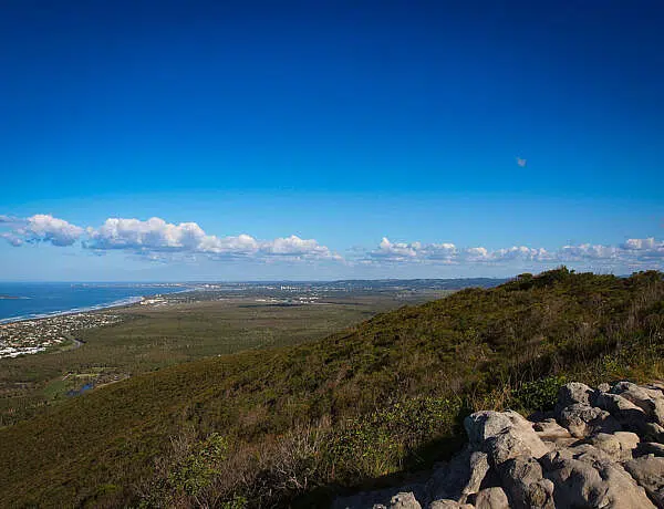
8. MOUNT YULLUDUNIDA | MOUNT KAPUTAR NATIONAL PARK (NSW)
MOUNT YULLUDUNIDA AT A GLANCE
From the giant Ormiston Pound crater in the Outback to a crater-that-is-not-a-crater in northern New South Wales: Mount Yulludunida at Mount Kaputar National Park is a short hike up a steep volcanic ridge line coupled with a rocky scramble at the end.

Again, the views are magnificent as you not only gaze into the volcanic crater below but also into the flatlands beyond.
It is one of those spots that feels completely different from the surrounding plains, and the sense of isolation at the top is brilliant. Just be prepared for the wind to pick up once you’re on the exposed rock—it can get pretty brisk up there.
9. LITTLE OBERON BAY | WILSONS PROM NATIONAL PARK (VIC)
LITTLE OBERON BAY AT A GLANCE
Although I haven’t been back in quite a few years, Wilsons Prom remains one of my favourite places in Victoria.

The national park is absolutely stunning with its squeaky white sand, granite peaks, abundant wildlife and plenty of hikes.
While the Tidal Overlook Circuit and the walk out to Tongue Point are both brilliant (especially in winter when you’ll hardly meet anybody out there), one of my top picks is the hike from Norman Beach around to Little Oberon Bay.
The track winds around Norman Point, offering you stunning views over the bay and various island groups. Whether you’re looking at the blue waters of Little Oberon or heading back into Norman Beach—the coastal views are terrific, even on overcast days.
10. ULURU BASE WALK | ULURU-KATA TJUTA NATIONAL PARK (NT)
ULUṞU BASE WALK AT A GLANCE
The Uluru Base Walk is entirely flat, which makes the 10km circuit much easier to manage if hiking isn’t exactly your thing.

Walking around the base of a giant rock might not sound all that exciting but trust me, it is. Uluru is far more fascinating than you’d imagine—culturally, geologically, and maybe even spiritually. It’s hard not to be touched by the sacred meaning of the place.
There’s something to discover at every turn: Unique formations in the rock, caves, ancient rock art, permanent waterholes and creation stories. Just be mindful of where you point your camera; several sections are culturally sensitive and should not be photographed.
If you head out early, you’ll avoid the crowds and witness the rock shifting through fascinating shades of ochre as the sun rises.
While many people only take the shorter Mala Walk, circumnavigating the entire base feels like a real achievement. It’s more of an experience than a hike, and everyone in my family came away with completely different, lasting impressions.
BEFORE YOU HEAD OUT
These ten hiking trails barely scratch the surface but they’re the standouts from all our trips across Australia (though there’s about another five that come in as very close seconds!).
As with any bushwalk, keep Australia beautiful and follow Leave No Trace principles. Finding rubbish—especially toilet paper—in the bush is a personal bugbear of mine, so pack out what you pack in.
Day Hike Essentials
If you’re wondering why a heavy hitter like the Kings Canyon Rim Walk didn’t make the cut, it’s simply because these other ten impressed us more. As for the Mount Kosciuszko Summit, we just haven’t reached that one yet—or if we did, the husband likely picked a day with zero visibility, so it doesn’t count.
What other epic Australian day walks should I add to my list?
Happy hiking,

Ready to plan your next big adventure? Head over to my comprehensive Australia Travel Resources to discover more rugged multi-day tracks, scenic road trips and stunning national parks across the country.
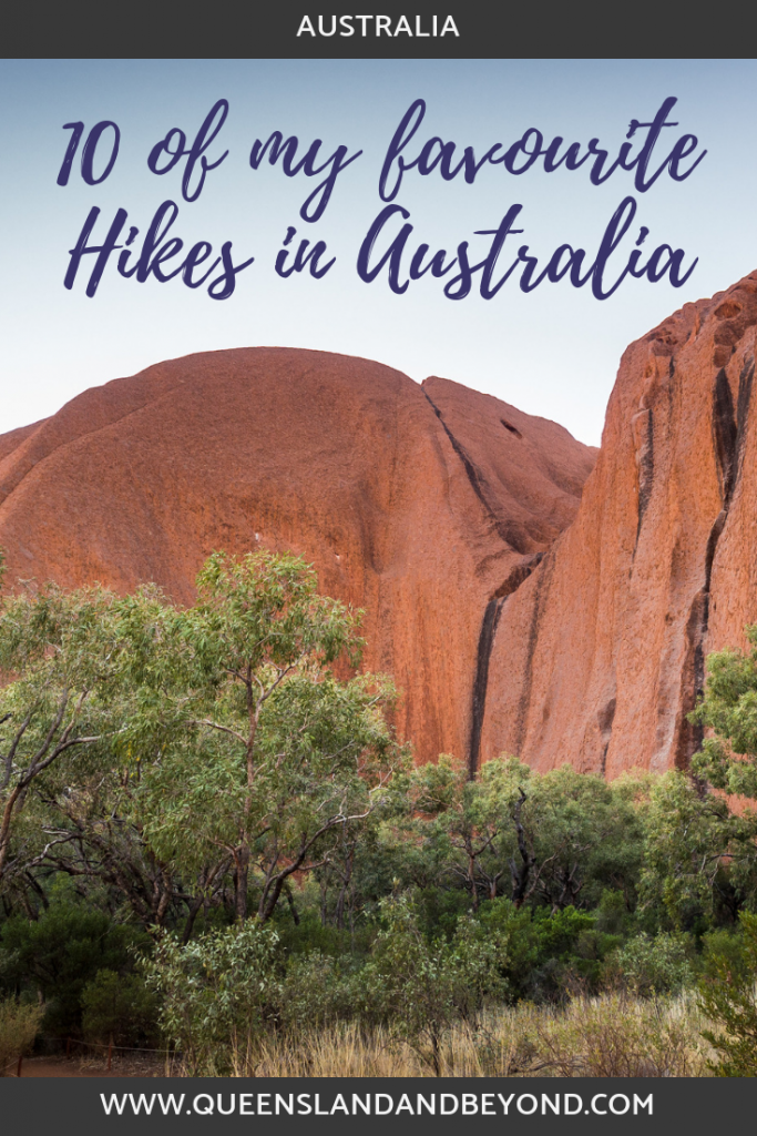
PIN IT!

2 Comments
Rod Hale
6 October 2020 at 1:33 PMHi, you might want to try the Breadknife and Grand High Tops walk in the Warrumbungles N.P.. The Main Range walk in The Kosciuszko N.P. is also stunning in good weather. I’ve done the Larapinta trail which is also magnificent; the climb to the top of Mt. Sonder for sunrise is special.
Overseas, the Haute Route in France and Switzerland and the Grand Traverse on the South Island of NZ are terrific.
I’ve just returned from walking in the Warumbungles and Mt. Kaputar N.P.s.
Kati
30 January 2021 at 5:32 PMHello Rod,
I’ve just realised that I never responded to you, my apologies.
Yes, the Warrumbungles are definitely on my list for places to hike but the pandemic kind of made NSW travel impossible last year. But maybe this year! I’d love to do the Larapinta, we visited the West MacDonells a few years back, and gee, I totally fell in love with the area (not sure I’d have the stamina for sunrise at Mt Sonder though!).
We’ve done the Routeburn part in NZ but not the full Grand Traverse. The Routeburn was absolutely stunning, you’re right there! Switzerland and France would be amazing to hike, I reckon, just a little impossible at present.