
This post contains affiliate links. If you buy something through these links, I may earn a small commission at no extra cost to you. I only recommend gear I’ve actually used out on the trails and really loved! Read my full disclaimer.
The Sandstone Belt national parks are on Aboriginal country. I acknowledge the Traditional Custodians of this area and their deep and ongoing connection to Country, and pay my respects to their Elders past and present.
Carnarvon Gorge is the heart of the ‘Sandstone Belt’ but the region itself is a massive, disconnected puzzle and encompasses far more than just ‘the gorge’.
You can’t visit it in a weekend, and you can’t drive it in a neat circle. If you try, you’ll waste heaps of fuel just to find out that two parks ‘touching’ on a map are actually a six-hour drive apart.
This guide is about making sense of the puzzle: Instead of a loop, look at your trip as a series of 2-3 day detours. Each park requires a dedicated trip off the bitumen and into the heart of the region.

SANDSTONE BELT AT A GLANCE
BEYOND CARNARVON GORGE
A Heads-Up: Carnarvon National Park is actually five separate sections: Carnarvon Gorge (most famous), Mount Moffatt, Salvator Rosa and tiny Ka Ka Mundi. The Moolayember section is inaccessible. None of these connect directly to each other by road.
Expedition National Park has two sections, Starkvale (east) and Beilba (west), and neither of these are in the same location.

Thrown into the sandstone mix are a few more national parks, from Nuga Nuga to Blackdown Tableland, Minerva Hills (no camping) and Isla Gorge.
It’s enough to make one’s head spin.
CHOOSE YOUR ADVENTURE: FROM SEALED ROADS TO REMOTE GORGES
Unless you’re out here for a month, you probably won’t see it all in one trip. Depending on your vehicle setup and how much you actually like “roughing it,” you’ll probably lean toward one of these areas:
- The Standout Choice: Carnarvon Gorge. The “crown jewel” of the Sandstone Belt: Towering sandstone, impressive Aboriginal rock art and lush side gorges. Don’t expect solitude.
- The 4WD Adventure: Mount Moffatt & Salvator Rosa. The ‘Roof of Queensland’ (Mount Moffatt). High-clearance territory with vivid rock art, sandstone formations and half the crowds.
- The Secluded Camping: Ka Ka Mundi. It’s tiny with a hidden spring and perfect solitude.
- The Isolated Gorges: Expedition (Starkvale & Beilba). Rugged, remote and often quiet.
- The Water Oasis: Lake Nuga Nuga. A birdwatcher’s paradise at the end of a rutted road.
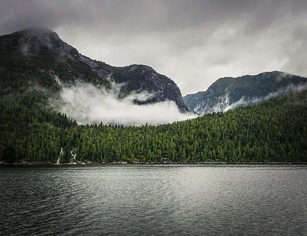
- The ‘Island in the Sky’: Blackdown Tableland. A high plateau that’s 5°C cooler than the plains. Perfect for a summer escape, and misty and atmospheric in winter.
- The Quick Road Trip Stops: Minerva Hills & Isla Gorge. Easy sandstone views.
| Location | Road Access | Last Fuel Stop | Facilities |
|---|---|---|---|
| 2WD Friendly (Sealed or Graded Gravel) | |||
| Carnarvon Gorge | 2WD (Sealed) | Rolleston / Injune | Camping Area / Toilets / Treated Water |
| Isla Gorge | 2WD (Short Gravel) | Taroom / Theodore | Camping Area / Drop Toilets |
| Minerva Hills | 2WD (Gravel/Steep) | Springsure | Picnic Tables (Day Use Only) |
| Blackdown Tableland | 2WD (Gravel) | Dingo / Duaringa | Camping Area / Drop Toilets |
| 4WD Required (Unsealed & Remote) | |||
| Expedition (Starkvale) | 4WD Only | Bauhinia / Taroom | Camping Area / Drop Toilets |
| Mount Moffatt | 4WD Only | Mitchell / Injune | Camping Area / Drop Toilets |
| Ka Ka Mundi | 4WD Only | Springsure | Camping Area (No Facilities) |
| Salvator Rosa | 4WD Only | Springsure / Tambo | Camping Area / Drop Toilets |
| Expedition (Beilba) | 4WD Recommended | Injune / Roma | Camping Area (No Facilities) |
| Lake Nuga Nuga | 4WD Only | Rolleston | Camping Area (No Facilities) |
WHEN TO EXPLORE THE SANDSTONE COUNTRY
This region in Central Queensland is a land of extremes. Because of the elevation (especially at Blackdown and Mount Moffatt), the weather doesn’t always match the coastal forecasts.
The shoulder seasons and winter are your best time to visit any of these parks. Quite a few close over the (wet) summer with roads and creeks becoming impassable.

WINTER (JUNE-AUG): THE BEST TIME
You’ll have crisp, blue-sky days (perfect for hiking) and little humidity. The flipside is that it can be biting cold at night. Places like Mount Moffatt and Blackdown Tableland can drop to below zero—the coldest we’ve experienced was -5°C at Mount Moffatt.
The Gear Tip: This is “heavy-duty down sleeping bag” territory, or as it’s known in our household “the fluffy one”. If you’re a cold sleeper like me, make sure you’ve got a very warm sleeping bag (rated to -10°C) or you’ll be miserable here.
Planning a winter visit? If you’re timing your trip for those crisp winter days, you won’t be alone at the main Gorge. Have a read of my guide to hiking Carnarvon Gorge so you can plan your logistics and make the most of your time there.
SPRING AND AUTUMN (APRIL-MAY AND SEP-OCT): THE WARMER MONTHS
It’s not as busy and you might see some wildflower displays (in September) but it’s also much warmer during the day. You’ll likely have more unpredictable weather and more rain.
SUMMER (NOV-MAR): INADVISABLE
Basically: Don’t do it.
It’s hot (35–40°C in the gorges), the flies can be relentless, and summer storms and flash flooding can occur at any time. Roads get cut off and you might be stuck for days.
Some of the parks become inaccessible. So unless you are very experienced with heat management and love being out in the remote Aussie bush in summer, stick to Blackdown Tableland (which stays cooler) or stay home.
NAVIGATING THE GRID: HIGHWAYS AND HUB TOWNS
Looking at a map of the Sandstone Belt is a bit deceptive. It stretches from Roma in the south to Emerald in the north. Blackdown Tableland is the closest to the east coast while Salvator Rosa is almost as far as Blackall in the Queensland outback.
To navigate this region without losing your mind, look at the Central Queensland highways as a grid.

Need the specifics? Given the disconnected location puzzle of the sandstone national parks, I’d suggest you pick a park or section and stick to it. You might want to start with my full guides to Mount Moffatt or Salvator Rosa for the specifics (just fyi, Google Maps likes to hallucinate directions!).
To get to Mount Moffatt, Carnarvon Gorge, the Beilba section of Expedition and Lake Nuga Nuga, treat the Carnarvon Highway as your main artery.
- Roma: Your last major hub with a major supermarket and other services.
- Injune: Your last stop for fuel, water and groceries (a small IGA) before the “detours” of Mount Moffatt, Carnarvon Gorge, Beilba (Expedition) and Lake Nuga Nuga.
- Springsure: Your gateway for the northern run to Minerva Hills, Ka Ka Mundi and Salvator Rosa.

To access Expedition (Starkvale/Robinson Gorge) and Isla Gorge, you need to be further east on the Leichhardt Highway.
- Taroom: Your last stop for fuel and supplies coming from the south
- Theodore: Your gateway if approaching from the north
For Blackdown Tableland, head to the Capricorn Highway.
- Emerald and Rockhampton: Your last stops for full supplies though you can get fuel in the smaller townships.
PREPARING FOR YOUR SANDSTONE ADVENTURE
Unless you’re only heading to Carnarvon Gorge and staying in accommodation, you do need to adequately prepare for a trip into the more remote parts of the Sandstone Belt.

GEAR BASICS: WHAT YOU ACTUALLY NEED
Because most of these national parks are off the main highways, you’ll find yourself driving mostly on unsealed, dusty or sandy back roads.
Sandstone Belt Gear Essentials
THE STICKY SOIL
It’s not quite the sticky black soil of Outback Queensland here but the sandy soil around places like Mount Moffatt turns into a gooey mess with even a little bit of rain.
The thick, sandy-clay mud clings to everything, particularly your tyres and axles, and getting bogged out here isn’t that fun (trust me, been there, done that).

If it rains while you are inside a park, stay put rather than trying to drive out. You’ll just slide around and get bogged.
If you’re heading into any of 4WD-only parks, you need to check the rain. This isn’t just “mud”—it’s sticky clay mud.
ESSENTIAL SUPPLIES AND SELF-SUFFICIENCY
FUEL & WATER
Fuel is your biggest logistical hurdle. If your vehicle has dual tanks, you’ll be fine. If not, fill up before heading away from the main highways.
- Top up in Injune, Rolleston and/or Springsure: Ensure you have enough fuel to actually get back out of the parks.
- Carry a Jerry Can: If you’re planning on doing a lot of the 4WD side-tracks in Expedition or Mount Moffatt, I’d suggest carrying at least 20L of spare fuel. It’s better to have it and not need it than to be doing the “will we make it” math on a sandy track.
GLUTEN-FREE OPTIONS
As someone who is GF and has other dietary restrictions, I usually bring most of my food from home. It’s just easier. If you have a specific diet, bring it with you or stock up before you get to your destination:
- Do any “proper” shopping in Roma or Emerald. These are your last places where you’ll find more than one brand of anything.
- You might find a loaf of gluten-free bread in the freezer at Injune or Mitchell but don’t rely on it. And don’t expect anything GF at the Big4 Carnarvon Gorge holiday park.
PLANNING YOUR SANDSTONE BELT ROUTE: 3 ITINERARY OPTIONS
Rather than doing it all, pick a couple of national parks and start there. Here are some quick ideas:

- 5 Days (The Standout): Best for first-timers who want the “Carnarvon Gorge” highlights or only have a 2WD.
- 7 Days (The Remote): Best for those who’ve “done” Carnarvon Gorge and want a sense of remote wilderness.
- 10 Days (The Full Circuit): The great escarpment adventure to the deep sandstone interior, knowing that you’ll be doing a bit of circle work.
Recovery Tip: If you’re coming off a few days of bush camping in the more remote sections like Ka Ka Mundi or Salvator Rosa, the Great Artesian Spa in Mitchell is a fantastic way to relax for a few hours. Soaking in thermal mineral waters after the sweat and dust of the bush is just a really nice way to finish your trip!
ROUTE A: THE 2WD SANDSTONE HIGHLIGHT
Focus: Carnarvon Gorge

- Day 1: Roma. Last big supermarket.
- Day 2-3: Carnarvon Gorge. Two days here gives you time for the Main Gorge and Boolimba Bluff without feeling like you’re in a race.
- Day 4: Mitchell. Recovery soak in the Artesian Spa.
- Day 5: Home.
ROUTE B: THE 4WD SANDSTONE “BIG HITS”
Focus: Expedition, Carnarvon Gorge and Mount Moffatt

- Days 1–2: Expedition (Robinson Gorge). Approach via Taroom/Theodore for rugged sandstone country and isolation.
- Day 3-4: Carnarvon Gorge.
- Day 5-6: Mount Moffatt. Plan two days minimum to spend in the High Country.
- Day 7: Home.
ROUTE C: THE 10-DAY “FULL SANDSTONE” IMMERSION
Focus: Expedition, Lake Nuga Nuga, Carnarvon Gorge, Mount Moffatt or Salvator Rosa

- Days 1-2: Expedition. Via Taroom/Theodore.
- Day 3: Lake Nuga Nuga. The “water oasis” detour with no facilities and a stunning valley drive.
- Day 4–5: Carnarvon Gorge.
- Days 6–8: Mount Moffatt (southbound) or Salvator Rosa (northbound). Give yourself a couple of days to enjoy the views from the “Roof of Queensland” or head into the bush for quiet camping at Salvator Rosa.
- Day 9-10: Mitchell & home. Recovery and a soak in the Artesian Spa (free camp outside Mitchell on the Maranoa River) before heading back home.
This is quite a full itinerary, and might feel rushed depending on how fast you usually move. Plan an extra 2-3 days if you like more time to relax.
Alternatively, swap Expedition for Blackdown Tablelands. It’s a great “soft” entry to plateau views, lush rock hole scenery and cooler nights.
If you’re driving the Leichhardt or Gregory Highways, Isla Gorge and Minerva Hills are the easy 30-minute leg stretchers.
A quick reality check: Before you close this tab and start packing, make sure you have the fundamentals sorted. You’re heading into a region that doesn’t really forgive laziness or ‘winging it’. Double-check your fuel math, make sure you have a physical map for when your phone inevitably lies to you, and—most importantly—check the weather. That sandy soil turns to a gooey mess fast, and a few hours of rain can be the difference between a great trip and a very expensive recovery bill.
RESPECTING THE SANDSTONE: A FEW GROUND RULES
I’d mostly just say ‘use common sense’ when venturing into this part of Queensland.
We’ve seen some fantastic sandstone formations out here but the heat is a real factor, even in winter. If you’re choosing to go in the warmer shoulder months, be prepared for the heat.
There’s an incredible amount of Aboriginal history, particularly rock art, here. Please view rock art respectfully and never touch it.

Lastly, remember that these environments are fragile. If you wouldn’t do it at home, don’t do it here. We always follow these Leave No Trace guidelines so we keep them that way.
READY TO PIECE YOUR PUZZLE TOGETHER?
I hope this post helps you plan your Sandstone Belt adventure. It’s absolutely worth heading into the more remote sections and switching off for a few days.
But whatever national park you pick, you won’t be disappointed.
Happy exploring,

No Comments