
This post contains affiliate links. If you buy something through these links, I may earn a small commission at no extra cost to you. I only recommend gear I’ve actually used out on the trails and really loved! Read my full disclaimer.
This part of Carnarvon National Park is on Bidjara and Nuri Country. I acknowledge the Traditional Custodians of this area and their deep and ongoing connection to Country, and pay my respects to their Elders past and present.
The first time we ventured into the Mount Moffatt section of Carnarvon National Park was during the winter of our first year on the Sunshine Coast.
The trip was incredibly rushed; we got rained out and only saw half of this stunning landscape. Five years later, we returned as we had unfinished business. I’m so glad we did.
High up in the central highlands and part of the Great Dividing Range, most of Mount Moffatt sits above 700m—known as the ‘Roof of Queensland’. Since I’m not exactly a beach bum, I’m far more drawn to the rugged, wild beauty of the Queensland outback and the wider Sandstone Belt.

Mount Moffatt is, hands down, one of my most favourite spots in the state.
MOUNT MOFFATT: WHAT TO KNOW BEFORE YOU GO
The national park lies in Queensland’s Sandstone Belt—think towering cliffs and rugged sandstone formations. While it’s one of four accessible sections of Carnarvon National Park, it’s a world away from popular Carnarvon Gorge.
Distance Warning: Although Carnarvon Gorge and Mount Moffatt look close on the map, and in fact, lie within hiking distance of each other, there is no direct driving route from one to the other. It’s at least a 4-hour detour (about ~350km) detour via Injune. Don’t plan on visiting both in a single day.
GETTING TO MOUNT MOFFATT
Mount Moffatt is roughly 700km west of Brisbane. You can approach via two main routes:
- From Injune: Approx. 140km (about 4.5 hours) via the Carnarvon Highway.
- From Mitchell: 200km (about 5-6 hours) on the Warrego Highway.
Both routes involve long stretches of unsealed roads, ranging from compact dirt to more sandy or softer conditions. Whichever way you choose, travel is fairly slow as roads can get pretty corrugated.
FROM INJUNE
Take either Westgrove Road or Womblebank Gap Road to reach Mount Moffatt Road.
One time we took Westgrove Road to Mount Moffatt, and then Womblebank Gap Road out to make a loop. Westgrove Road is slower—it’s got a ton of floodways and creek crossings—but we wanted to see the scenery.
Womblebank Gap Road is much faster as most of it is now paved, leaving only the last 50km on dirt.

Keep in mind that Westgrove Road can be very dusty when dry but after a bit of rain, it can turn into a sticky clay pan. Staying on the road becomes a serious challenge (we’ve been there!).
FROM MITCHELL
Take Forest Vale Road just outside Mitchell, then follow the signs to Mount Moffatt Road.
Another time we came from Mitchell, and while we didn’t find it particularly scenic, the drive was so incredibly fast, we could hardly believe how quickly we got to Mount Moffatt compared to our first trip.
About 10km south of the national park boundary, you’ll pass the historic Old Slab Hut. It’s the perfect spot for lunch and worth a quick look around.


BEST TIME TO VISIT
The best time to visit Mount Moffatt is during the cooler months of the year (late April to September). It does get cold in the middle of winter (below 0°C) but the days are gorgeous. You’ll have clear blue skies and sunny weather.
Summer is simply too hot and the roads might get cut off with the wet season in full swing. If you don’t mind warmer temperatures, shoulder season (Oct/Nov) could be ok but be prepared for hot days and bring enough water to last you your entire stay in the park.
HOW MUCH TIME TO PLAN
The first time we camped at Mount Moffatt, we had less than 24 hours in the park.
Partly because we were unprepared for how long it would take to cover the distance between the two sections, partly because someone had told us that Mount Moffatt wasn’t very exciting, and partly because we got rained out and thus sat in the tent debating what to do instead of doing it.
The next time we spent two nights camping at Mount Moffatt because I was adamant that I wanted to explore all the walks, do the scenic drive again and not rush around like a crazy chook.
So, my recommendation would be to spend at least two nights, more if you prefer to take things leisurely and/or aren’t up for doing all the walks in a day. It’s a long way to come just for a night, and the camping areas are really nice.

CAMPING AT MOUNT MOFFATT
Camping at Mount Moffatt is a true back-to-basics experience. You need to be entirely self-sufficient—the only thing provided is a drop toilet and a rainwater tank at each camping area.
Camping here is fantastic though. Even during winter school holidays, it’s never so busy as to put you off. You’ve got four distinct camping areas to choose from, each with its own advantages.
My personal favourite is definitely Rotary Shelter Shed. It gets pretty cold up there on the tablelands but with sprawling views over the highlands is hard to beat.

Just keep in mind that the 4WD track leading to this camping spot gets seriously wet and dangerous. It’s often closed if conditions are too wet.
Want more camping details? Have a look at my guide on the different camping areas at Mount Moffatt so you know what to expect at each one.
ESSENTIAL PREP & GEAR FOR YOUR 4WD ADVENTURE AT MOUNT MOFFATT
Since Mount Moffatt is some 700km west of Brisbane, you need to make sure you’re prepared for a trip into this remote corner of Queensland.
Here are a few essential tips for your adventure:
- Supplies & Fuel: Do your main shop in Roma if you’re not coming from home or have supplies. The small IGAs at Injune or Mitchell are only for top-ups. Fuel up in Injune (~110km) or Mitchell (~200km); and remember to factor in enough fuel for the scenic drives around the park.
- Vehicle Access: This is high-clearance 4WD territory only. Check local road conditions at QLD Traffic or parks alerts before heading out.
- Water: There is some tank rainwater at Mount Moffatt but don’t rely on it. After a dry summer, there may be little in the tanks. Plan a minimum of 5–7L per person, per day, plus extra for emergencies.
- Weather: Even if the days are warm and sunny, the temperatures can drop to below 0ºC overnight in winter. Bring plenty of layers.
- Emergency Supplies: Help can be hours away so have a first-aid kit handy and extra food in case you get stranded.
Mount Moffatt Gear Essentials
WHAT TO SEE & DO AT MOUNT MOFFATT
At Mount Moffatt, you won’t find the rising sandstone cliffs that Carnarvon Gorge is so famous for but you can enjoy sprawling valley views, fascinating Aboriginal rock art and, best of all, far fewer crowds.
SCENIC DRIVES
MOUNT MOFFATT CIRCUIT DRIVE
To visit the main sights at Mount Moffatt (see the next section), you’ll naturally be driving around the park but doing the whole Mount Moffatt Circuit Drive is worthwhile regardless.

On each of our visits, the main road in the park wasn’t too rough but the tracks are sandy (on the circuit drive) so driving can be slow-going at times. Also, keep in mind that while the park isn’t huge, you can easily rack up 100km just driving around. Having spare fuel is handy (if not necessary) so you can actually make it back to civilisation.
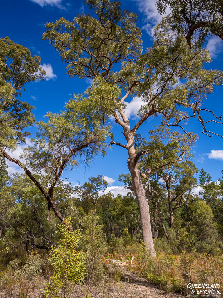
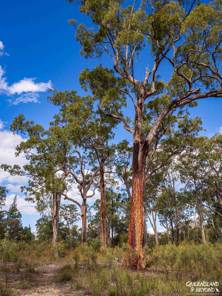
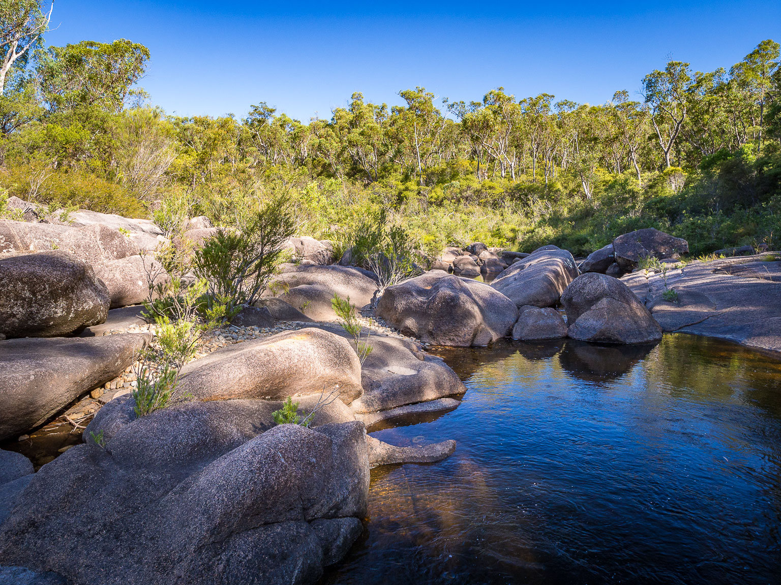
Just on the loop drive, the vegetation changes from sandy tracks lined with gorgeous gums and eucalypt trees, open woodland to grassy plains where you’ll most likely see some wildlife. Plus, you’ve got all the main sights on this track.
HIGH COUNTRY DRIVE
The second scenic drive you can take, and one I definitely recommend you do, is the High Country Drive up onto the Consuelo Tableland and to the Head of Carnarvon. You’ll get some fabulous views into the plains and tablelands along the way.

A note of caution, this road really is a 4WD track.
If it’s dry, it’s no problem at all. In the wet though, the track turns into slippery, gooey black clay mud that wants to swallow up your feet whole. On our very first trip, we camped at Rotary Shelter Shed and it rained so heavily overnight that we basically slid down the hill on our way home. That’s exactly why this track often gets closed—but if it’s open, I’d say seize your opportunity!
As you follow the track, you could stop at the Rotary Shelter Shed camping area and marvel at the views, or keep going to the lookout at Top Shelter Shed. There’s a picnic table with views that are hard to beat.

From there the track takes you through the gorgeous Mahogany Forest, full of beautiful stringybark trees, macrozamia palms and lots of wildflowers. I just love driving through there.

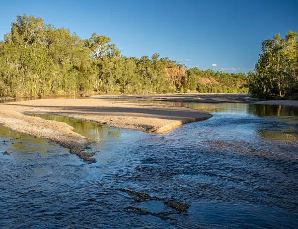
The track ends at the Head of Carnarvon Creek, which is where the headwaters of Carnarvon Creek begin. However, we tried finding the exact spot and it’s pretty much impossible.
It is a little disappointing though as there’s not much of view or anything to see. One time we scrambled around and almost walked into a rotting and stinky wild pig carcass.

KENNIFF DRIVE & TOP MOFFATT
If you want to explore, there are two other minor tracks in the park, though both are much less scenic than the High Country Drive.
- Kenniff Drive: Turn off to do the Kenniff Drive, which in itself isn’t that exciting. The road ends at a locked gate at the incineration site where the Kenniff Brothers are believed to have burnt their murder victim (more on that below).
- Top Moffatt: The drive out to Top Moffatt is about 15km (one-way) but again, there isn’t much to see along the way and there are no views at the camping area. You could explore the old homestead site but there’s not much left to see here (ie. nothing).
SHORT WALKS & SIGHTS
Surprisingly, there are more walks to do than you might expect for such a remote spot in Queensland. You could easily spend a day or two hitting the various trails and seeing some pretty special sights at Mount Moffatt.
Walks range from short 50m tracks to 6km hikes, looping around some stunning sandstone formations. And being so remote, you’re unlikely to meet anyone and will likely have the sights all to yourself.
SHORT WALKS
There are plenty of short to very short walks at Mount Moffatt, from Cathedral Rock and Kookaburra Cave to Marble Arch.
CATHEDRAL ROCK (380M RETURN)
Cathedral Rock is one of the first stops as you enter Mount Moffatt. It’s a massive sandstone bluff that you can get up and close with. There’s some rock art (hand stencils) on one of the ledges. Be careful not to touch it, rock art tends to be very fragile and is easily damaged (plus, you want to be respectful).


MARLONG ARCH (200M RETURN)
3km past the camping area at Dargonelly’s Rock Hole (along Circuit Drive) is Marlong Arch. You can see the soft sandstone arch from the road but it’s worth a stop and exploring the area a bit.


KOOKABURRA CAVE (1.7KM RETURN)
Keep going along Circuit Drive to reach Kookaburra Cave, which is a small overhang with an Aboriginal stencil that resembles a kookaburra. I really liked this piece of rock art.


LOT’S WIFE
Lot’s Wife is a giant sandstone pillar not far from Kookaburra Cave. You can walk around the entire pillar but try not to climb it since the sandstone is so soft and fragile. Pick up a broken piece from the ground, you’ll see that it’ll literally break in your hands.
The name must be a reminder of the biblical story of Lot’s wife (and their daughters) being turned into a pillar of salt after she looked back to Sodom and Gomorrah when God told them not to turn around.


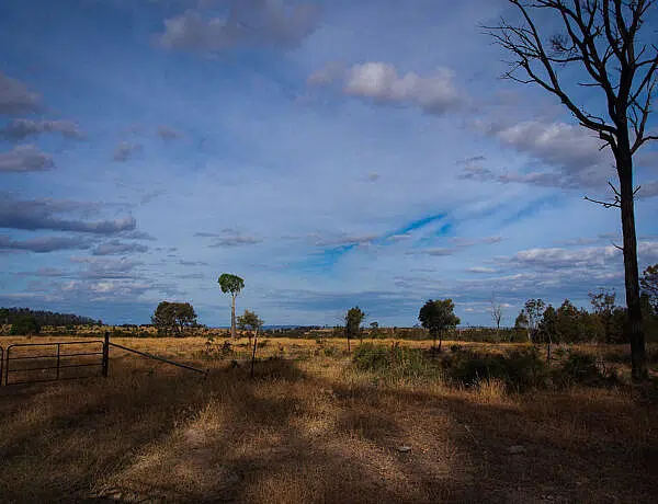
MARLONG PLAIN
This plain is actually one of our favourite spots at Mount Moffatt. From the locked gate, you can walk out onto to a large grassy plain from where you can spot sandstone cliffs and ridges in the distance. In the late afternoon, the grass gets all lit up and sun creeps over the cliffs giving them beautiful golden hues.
We didn’t see anyone else out here, and there really isn’t that much to see but it feels like a calm and serene spot.

LONGER CIRCUIT WALKS
If you’re up for bigger hikes, Mount Moffatt has distinct circuit tracks. One is excellent and will take you to some fascinating rock art while the other is a quiet and largely unspectacular bushwalk that’ll be more exercise than anything else.
THE MARANOA RIVER CIRCUIT
The Maranoa River Circuit At a Glance
The Maranoa River Circuit takes in three separate landmarks: The Tombs, the Chimneys and the Looking Glass. You can visit each of these individually as shorter return walks from the Sandstone day-use area but combining them makes a fantastic loop.
(Note: Queensland National Parks officially calls this the Maranoa River Circuit, which is easily confused with the shorter Maranoa Circuit located at West Branch camping area).
The track starts opposite Cathedral Rock, near the cattle grid at the park entrance. This is only spot in the park where you’ll find toilets (besides those in the camping areas).

You can do the loop in either direction but hiking it anti-clockwise is actually very nice. In any case, you can’t really get lost as you just follow the single file, sandy track.
The Chimneys (1.4km return): Heading anti-clockwise, this is your first stop where you can see three distinct sandstone pillars left standing on a bluff while the rest of the top has eroded away.

The Tombs (4.2km): Of the three sites, this one is definitely my favourite. The Tombs are an Aboriginal burial site, something you can’t experience in many spots. Walking along the foot of the giant rock wall with its carved-out burial chambers feels special and sacred. This remains a sacred creation site for the Bidjara people so keep that in mind as you wander along.
Unfortunately, the burial chambers were desecrated in the early 1900s. As Queensland National Parks points out that,
Sadly, by the end of the 19th century, the site had been robbed of this material, leaving little evidence of an elaborate mortuary culture.
QUEENSLAND PARKS & WILDLIFE SERVICE
You’ll also find some of the most vibrant Aboriginal rock art are in Queensland at The Tombs. There are over 400 ochre stencils, some are so amazingly vivid, you wonder how they’ve been preserved like this.

Like with all rock art sites, strictly stay on the boardwalk and leave the overhang and rock wall untouched.
Looking Glass (1.9km return): The last sight on the loop is another eroded sandstone structure high up on a precipice. Wind has tunnelled completely through the rock to form a “looking glass” that stands guard beside the (dry) Maranoa River.


MARANOA CIRCUIT WALK
Maranoa Circuit Walk At a Glance
The Maranoa Circuit is a flat loop through open bushland, starting at the West Branch camping area.
If you try to look this track up on the official Queensland National Parks website, you won’t find it listed at all—but it is definitely there on the ground! To find the walk, look for the Carnarvon Great Walk signs on the left side of the road. You’ll probably spot the swing bridge.

The neatest part of the walk really is crossing the (dry) Maranoa River via a swing bridge. We tried swinging it a bit but it’s a fairly solid structure!
From there, you follow along the Carnarvon Great Walk for a short distance before turning off onto a circuit loop back to the bridge.
Aside from the swing bridge, it’s not the most exciting bushwalk but it’s pleasant enough if you want stretch your legs. We spotted a wallaby or two, and the smooth-barked apple trees and eucalypt trees are quite beautiful.
PASTORAL & OUTLAW HISTORY
Beyond the sandstone formations, you can also learn quite a bit about early settler history at Mount Moffatt. The park information shelter is actually a really good starting point and has heaps of info panels outlining the history, flora, fauna and more.
OLD STOCKYARDS
With Mount Moffatt being old cattle country, you can meander around some old stockyards near the ranger’s hut and information shelter. Even though they’ve been repaired to some extent, the original stockyards were first built over a hundred years ago (1902).


KENNIFF INCINERATION SITE
Lastly, if you learned about the Kenniff Brothers at the info shelter, head out to the Kenniff Incineration Site.
The Kenniff Brothers are believed to have murdered a police constable during a shoot-out in the early 1900s. Historical evidence suggests that the brothers then burnt the body near a creek bed at Mount Moffatt where there’s the plaque commemorating the constable today.
The brothers were wanted for cattle stealing, a crime that was rampant in the area at the time. The double murder then led to a Queensland-wide manhunt, and both brothers were eventually tried and sentenced in 1903.

While there isn’t much to see at the incineration site beyond a plaque and a dry creek bed now, heading out there still brings this part of history a bit more alive. The Kenniff Cave, where the Kenniff Brothers are said to have hidden out, is, unfortunately, now closed due to unstable rock layers.
WRAPPING UP THE ADVENTURE
The Mount Moffatt section of Carnarvon National Park easily offers enough to keep you exploring for at least a couple of days. Along with sections like Salvator Rosa, it shows just how diverse this massive national park really is.
While the winter months get incredibly cold overnight, I still reckon it’s the best time of the year to come. Clear blue sky days and quiet camping make the long trek out here completely worth it! Just make sure you’ve packed a super warm sleeping bag and lots of layers to wear, and you’ll be right! 🙂
Mount Moffatt is remote, rugged and deeply beautiful, and the rock art is some of the most vivid you’ll ever find. This wild corner of the Sandstone Belt has certainly got a firm spot in my heart.
Happy exploring,

Mount Moffatt Resources
Note: Always check the park alerts before loading up the 4WD—heavy rains may trigger temporary track closures on the High Country Drive.
SAVE TO PINTEREST


6 Comments
Marg
11 May 2022 at 1:40 PMWow.. Awesome information..
Thanks very much..
Kati
5 June 2022 at 1:10 PMYou’re welcome 🙂 (Not sure how up to date this post still is, haven’t been out to Mount Moffatt in a couple of years 🙂 )
Arthur Brennan
25 February 2026 at 10:00 PMCan you get an off road high clearance caravan into Mt Moffatt? Cheers
Kati
28 February 2026 at 6:02 PMHi Arthur,
Yes, you definitely can (as long as it’s not too wet, the road can get a bit muddy otherwise). I probably wouldn’t camp at Rotary Shelter Shed (the sites are very small and uneven, and you’d probably struggle getting a caravan in). West Branch camping area or Dargonelly Rockhole would probably be your best options for setting up a caravan. I’ve got a whole post on the camping areas at Mount Moffatt if you want more details: https://queenslandandbeyond.com/carnarvon-mount-moffatt-camping-guide/
Cheers
Kati
Mark
21 November 2022 at 2:33 PMGreat information thank you. Even if it is a bit outdated, the walks and sights aren’t likely to change. Appreciate your honest opinions.
Kati
10 January 2023 at 9:55 AMHi Mark,
Sorry for the slow response, Christmas craziness and all. 🙂 Thanks for your comment, always nice to hear that it’s useful. And yep, it’s been a few years since we’ve been to Mount Moffatt but as you say, the walks aren’t likely to change dramatically.