
This post contains affiliate links. If you buy something through these links, I may earn a small commission at no extra cost to you. I only recommend gear I’ve actually used out on the trails and really loved! Read my full disclaimer.
The Salvator Rosa part of Carnarvon National Park is on Kairi Country. I acknowledge the Traditional Custodians of this area and their deep and ongoing connection to Country, and pay my respects to their Elders past and present.
The Salvator Rosa section of Carnarvon National Park in the Sandstone Belt doesn’t offer anywhere near the spectacular sights that Carnarvon Gorge has. It also doesn’t have the rugged beauty and Aboriginal rock art you can find at Mount Moffatt.
But if you’re after a peaceful camping experience while enjoying some sandstone formations, then Salvator Rosa is just the place.

SALVATOR ROSA: WHAT TO KNOW BEFORE YOU GO
Carnarvon National Park is no doubt the most popular national park in Central Queensland.
Most people don’t realise though that Carnarvon National Park has five accessible sections: Carnarvon Gorge, abutting Mount Moffatt, Salvator Rosa, tiny Ka Ka Mundi and Goodliffe.
The towering sandstone cliffs of Carnarvon Gorge are the most well-known part of the national park, and are definitely a must-see. But if you want a bit more peace and quiet, Mount Moffatt or Salvator Rosa give you that perfect remote bush experience.

We explored this section as part of a 10-day road trip through the Sandstone Belt region that included Blackdown Tableland National Park (near Emerald), Ka Ka Mundi, Mount Moffatt and the (now closed) Lonesome section of Expedition National Park.
HOW TO GET TO SALVATOR ROSA
The Salvator Rosa section of Carnarvon National Park is the furthest one from the coast, being about 930km northwest of Brisbane.
That’s a long way to come.
Whether you’re coming from the coast, the north or the west, you’ll probably come along the Dawson Developmental Road and then onto Cungelella Road.

If you’re heading west (or coming from the west), you can also take Mount Playfair Road but that’s only suitable for dry conditions and high-clearance 4WDs. It’s the way we left as we were heading to Mount Moffatt via Mitchell afterwards.
Since you’re travelling mostly on unsealed roads, access to Salvator Rosa is 4WD-only. Wet conditions can quickly make things dicey out here turning dirt roads into sticky clay disasters that will ruin any traction you might have had.

We did see off-road caravans out here but there are sandy sections closer to the national park that make towing a bit more challenging at various times.
Travel can be slow because of corrugations or, frequently for us, cattle on the road.
BEST TIME TO VISIT
Like any of the Carnarvon National Parks sections, the winter months are the best time to explore Salvator Rosa. April can still be quite hot and by September temperatures are on the rise again so anywhere between May to late August would be just about perfect.
Expect cold temperatures (even to 0°C) overnight in the middle of winter but beautiful clear skies on most days, and low to mid-20°Cs during the day.
Summer is very hot and the park will actually be closed if there’s fire danger and/or extreme heat.
HOW MUCH TIME TO PLAN
It’s takes time and effort to get to Salvator Rosa so it makes sense to spend at least a couple of nights.
We had one full day (two nights) here and that was as much time as we needed to explore the park.
We were on a one-week Sandstone Belt itinerary so didn’t have much more time to spend than two nights. If you don’t want to rush and spend time relaxing in your campsite, plan 2-3 days.
CAMPING AT SALVATOR ROSA: NOGOA RIVER CAMPING AREA
Nogoa River Camping Area At a Glance
Pros: Remote, peaceful and lots of space; picnic tables in some spots; Nogoa River nearby
Cons: Not a ton of privacy due to camping in one large open area; no individual sites; no views as such
Cost: $7.75 per site/per night (2026); Pre-bookings required via the QNP Booking Service

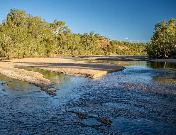
The Nogoa River camping area is the only camping spot at Salvator Rosa. It’s about 2.5km into the park past the park boundary.
The camping area is one large, unmarked semi-shaded area that’s close to the Nogoa River but not directly on it. You can walk to the creek but you can’t actually see it from the camping area.
There’s plenty of space but it might feel a bit cramped if it was at capacity (40 people). There are also a few picnic tables and fire rings strewn about so you can sort of use these to pick a site that you like.

QPWS states that it’s suited only to 4WD-vehicles and off-road camper trailers but we saw off-road caravans there too. I guess it all depends on the road conditions and your setup—keep in mind that the tracks into the park are firm but reasonably sandy.
Because it’s one large area without designated sites, there’s not much privacy. The trees give you some sort of separation but it’s not my favourite way of camping.


That said, it was fairly quiet with only two, three other campers around, and the lack of privacy didn’t matter too much.
There’s no reception in the park so remember to prebook your site. You’ll only be in range near Springsure or Tambo.
Camp responsibly: Remember to take your rubbish with you, don’t collect firewood in the national park, and always leave no trace during your stay.
ESSENTIAL PREP & GEAR FOR YOUR ADVENTURE AT SALVATOR ROSA
Salvator Rosa is in a remote part of Queensland—the closest town Tambo is still over 100km away so it’s important to come prepared.
Here are a few essential tips for your adventure:
- Fuel Needs: The nearest fuel stations are in Springsure (~170km) or Tambo (~135km via Mount Playfair Road—high-clearance 4WDs only).
- High-Clearance 4WD Only: This section is only suitable for 4WD vehicles. Check local road conditions at QLD Traffic or parks alerts before heading out.
- Leave Gates: You will be driving through private cattle properties on your way to Salvator Rosa. Leave all gates exactly as you find them
- Water Supply: There is no water at Salvator Rosa. Plan a minimum of 5–7L per person, per day, plus additional water for emergencies.
- Last Supplies: Your last shopping options are the very small supermarkets at Springsure or Tambo. Stop at Roma or Emerald if you need to do a proper shop.
Salvator Rosa Gear Essentials
WHAT TO EXPLORE AT SALVATOR ROSA: A SCENIC DRIVE (19.2KM RETURN)
If Mount Moffatt is quiet, Salvator Rosa is positively deserted so you’re unlikely to run into too many people as you explore the park.
Spend the day driving through the park to explore the sandstone formations and springs. It’s perhaps not much of “scenic” drive as such but it is definitely pleasant. And since you’re here, you ought to drive to the end of the one accessible road in the national park.

STOP 1: SPYGLASS PEAK CIRCUIT (2KM LOOP)
Spyglass Peak Circuit At a Glance
The Spyglass Peak Circuit is a definite must-do at Salvator Rosa.
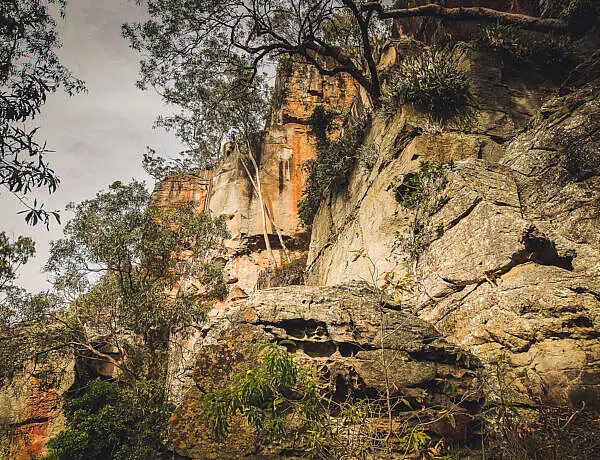
It’s only a short walk and not particularly challenging. But you’ll get impressive views of the 10m diameter hole piercing the top of Spyglass Peak.

The walk starts at a grand natural sandstone wall (alternatively called Great Wall or Hadrian’s Wall). It’s pretty amazing to think that people didn’t build this given how straight it appears to be.
From there you traverse across a sandstone landscape that’s reminiscent of a moonscape—or what I imagine it’d be like.


There’s no formed track across the sandstone outcrops but orange markers are painted in various spots to help you stay on track. Basically just head towards Spyglass Peak and you’ll find the trail back to the carpark.
Sandstone breaks really easily so don’t run around smashing it needlessly. You’ll probably feel it crunching under your feet.

PHOTOGRAPHY TIP: If you do the walk in the late afternoon, you’ll look straight into the sun but the spyglass is also nicely lit up. In the morning, the sun should be behind you and hopefully light up the rocks. We did the walk again the next morning but unfortunately, it was overcast and I didn’t get the sun glow I was hoping for.
STOP 2: LOUISA CREEK & BELINDA SPRINGS
There’s a covered picnic area at Louisa Creek where we spent ages exploring the creek, crawling around to discover tiny Belinda Springs (follow the gurgling sounds!).
We followed this with morning tea while watching emus chasing each other—hilarious.


STOP 3: HOMORANTHUS HILL LOOKOUT (0.3KM RETURN)
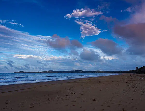
This very short but steep walk to the top of Homoranthus Hill offers splendid views of Spyglass Peak and the surrounding sandstone rock formations. It’s a good spot to hang out for sunset if you’re not busy cooking dinner in the campground.

Apparently the hill is named after a rare shrub that flowers in spring, homoranthus zeteticorum.
STOP 4: MITCHELL SPRINGS
From the camping area, it’s just under 10km to drive to where the road ends at Mitchell Springs—a locked gate bars any further adventures. You can’t see the springs here since they’re underground but you’ll notice how green and lush the clearing is.

We probably spent a good three hours doing this scenic drive (without doing the Spyglass Peak walk) but it doesn’t take that long. It’s just that we like to explore and wander around. 🙂
If you just want to drive to the end, it’s probably less than an hour return (though keep in mind that the road is quite sandy).
HISTORICAL REMNANTS AT SALVATOR ROSA
Unlike at Carnarvon Gorge and Mount Moffatt where you find some stunning examples of Aboriginal rock art and early settler history, Salvator Rosa only gives a hint of history.
A plaque in the camping area attests to explorer Thomas Mitchell and his fellow companions camping in this area in search of the Gulf of Carpentaria in 1846. Apparently he was pretty happy to discover some of the local water springs at Salvator Rosa after travelling for weeks and weeks along dry riverbeds.

ODD FUN FACT: The sandstone spires and crags reminded Mitchell of 17th century Italian painter Salvator Rosa’s landscape paintings, and so named a lake and a mountain after him. And obviously that name stuck with this national park section.
In the mid-late 19th century, the land was used for sheep and then cattle grazing. The only evidence you can see today (beyond nearby cattle stations) are a few fence posts near Mitchell Springs (at the end of the road).

WRAPPING UP
Although Salvator Rosa is a long way from the other sections of Carnarvon National Park, it’s a good spot to hang out for a couple of days.
We really enjoyed it, even if there’s not as much to do as at the other sections. And sometimes that’s exactly what you need.
Happy exploring,

Salvator Rosa Resources
Note: Check the park alerts before you head off—heavy rain results in temporary track closures.
LIKE IT? SAVE TO PINTEREST


No Comments