

This post contains affiliate links. If you buy something through these links, I may earn a small commission at no extra cost to you. I only recommend gear I’ve actually used out on the trails and really loved! Read my full disclaimer.
Girraween National Park is on the boundary of Jukambal, Bundgalung and Kamilleroi Country. I acknowledge the Traditional Custodians who met and continue to meet in this area and their connection to Country. I pay my respects to their Elders past and present.
Girraween National Park is one of the most popular national parks in South East Queensland. It’s a granite boulder wonderland full of walking trails, wildlife and wilderness.
The park sits directly on the border to New South Wales, sharing the area with Bald Rock National Park on the New South Wales side.

GIRRAWEEN NATIONAL PARK: TIPS FOR YOUR FIRST VISIT
GIRRAWEEN NATIONAL PARK AT A GLANCE
Not far from Stanthorpe in the Granite Belt, Girraween is a fantastic spot for getting a dose of nature. The walks all offer something different, and the views over the granite outcrops are wonderfully expansive.
But it is a popular national park so don’t expect to find yourself alone here, especially on weekends and over the school holidays. It is, after all, one of a dozen great 2WD-accessible national parks in Queensland.
The husband and I both reckon that Girraween is probably one of the best national parks in South East Queensland, if not all of Queensland, to take kids to and do some family hiking.

BEST TIME TO VISIT
Girraween is a great spot for camping and hiking at any time of the year.
Summer is warm to hot (mid-20°Cs to low 30°Cs) but being right on the border to NSW, nights tend to be cooler. If the days are particularly hot, just go exploring early in the morning to make the most of the cooler temperatures.
Winter, on the other hand, is chilly at night, down to an average of 1°C (and maybe even negative temperatures). Frost and even snow overnight is not unheard of around the area of Stanthorpe. But the days are usually clear and blue sky, and with that invigorating freshness that only cooler climates can have.

Mid-autumn and late winter are fantastic times to visit but even summer can be good as it might be a bit cooler than other parts of the South East. For hiking, the shoulder seasons are perfect—not too cold at night nor too hot during the day. Spring to early summer (mid-/late August into October/November) will also deliver up a smorgasbord of wildflowers.
HOW TO GET TO GIRRAWEEN
Girraween is only 30 minutes from Stanthorpe (~35km) so you could easily stay in or around Stanthorpe if you don’t feel like camping and just do day trips.
From Brisbane it’s about a 3-hour drive (~250km) south, and while not around the corner, that’s still doable for a long weekend.
You can easily find Girraween National Park from the New England Highway, just follow the signs to Pyramids Road. The road into the national park is fully sealed but becomes unsealed past the Bald Rock Creek day-use area (e.g. if you want to go to the eastern walks, the road to that trailhead is unsealed).
An unsealed internal track (Mount Norman Road) bisects the national park (past the Dr Roberts car park) to Mount Norman day-use area is 4WD-only; it’s quite sandy in spots and best driven in dry weather only. If you want to go to the Mount Norman car park in a 2WD vehicle, you’ll need to head back to the New England Highway and loop back around further south to the sealed part of Mount Norman Road.
HOW MUCH TIME TO PLAN
Plan at least two nights here, more if you like relaxing in your campsite while also having enough time to hit all the sights.
The first time we camped at Girraween, we arrived late in the afternoon (after having driven over 300km from Mount Kaputar National Park in country NSW), had the next day to explore all the hiking trails and then left the following morning. It was rushed and a tad on the manic side.
At other times we’ve had three nights. This gives you two full days to explore the trails, allowing for early morning and late afternoon hikes if you don’t want to go in the middle of the day. Three nights also gives you time to hang around your campsite and take a breath.
CAMPING AT GIRRAWEEN

Girraween now has three camping areas in the national park: Terrawambella, Kambuwal and Castle Rock. They are all very close to the walking tracks and the visitor centre.
Some of the campsites are more suited to larger setups (like caravan or camper trailers) or some better for tents with platforms. There are flush toilets and (non-potable) water in all three camping areas.
Need help choosing a campsite? Check out my comprehensive Girraween Camping Guide where I discuss the specific campsites, layouts and facilities for all three camping areas.
You could also stay at the nearby Girraween Country Inn and then visit Girraween for a day or two.
A FEW HANDY THINGS TO PACK FOR GIRRAWEEN
Since you are within easy reach of Stanthorpe, you don’t need to be ultra-prepared but it does pay to have a few essentials on hand.
The most important thing you’ll want to pack is water:
- Girraween is in a region of Queensland that often experiences drought and water is scarce here. While there are flush toilets, there is no drinking water available in the park (the campsites have limited non-potable water) so come prepared.
A Few Handy Things to Pack for Girraween
GRANITE PEAKS AND ROCK FORMATIONS: GIRRAWEEN HIKING TRAILS
Girraween is a standout in my collection of South East Queensland hikes, offering some of the best granite rock scrambling in the state.
There are four formal trailheads in the park: Northern, Southern, Eastern and the Mount Norman day-use area (though it’s barely more than a car park). You can easily access the first two (Northern and Southern) from the Bald Rock Creek day-use area (also called “Girraween day-use area” on Google Maps) and the adjacent camping areas but you will need to drive to the Eastern trailhead (unsealed) and the Mount Norman day-use area if you’re camping at Girraween.
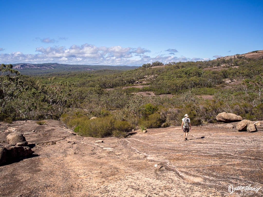
All the walks are fairly exposed though the shorter tracks provide more shade cover than the longer ones, especially those climbing up and across giant granite slabs.
NORTHERN SECTION: TRAILS FROM BALD ROCK CREEK DAY-USE AREA
Girraween now has a shiny new visitor centre so head there first if you want to learn more about the local environment and get info from the rangers on current trail conditions etc. Otherwise take your pick from one—or all—of these trails, you can quite easily loop them to create a longer walk.
Girraween is very well signed so you won’t get lost anywhere (unless you venture off-track, of course).
GRANITE ARCH CIRCUIT
Granite Arch Circuit At a Glance
The Granite Arch Circuit is a really easy stroll away across the bridge of Bald Rock Creek to the fairly massive boulder archway halfway along the track.

It’s only a short walk and not super incredible but this track is very family-friendly and you can easily combine it with Bald Rock Creek Circuit to turn it into a longer walk (~3.5km). Plus, you don’t get to walk through an arch under a massive granite boulder every day of the week.
BALD ROCK CREEK CIRCUIT
Bald Rock Creek Circuit At a Glance
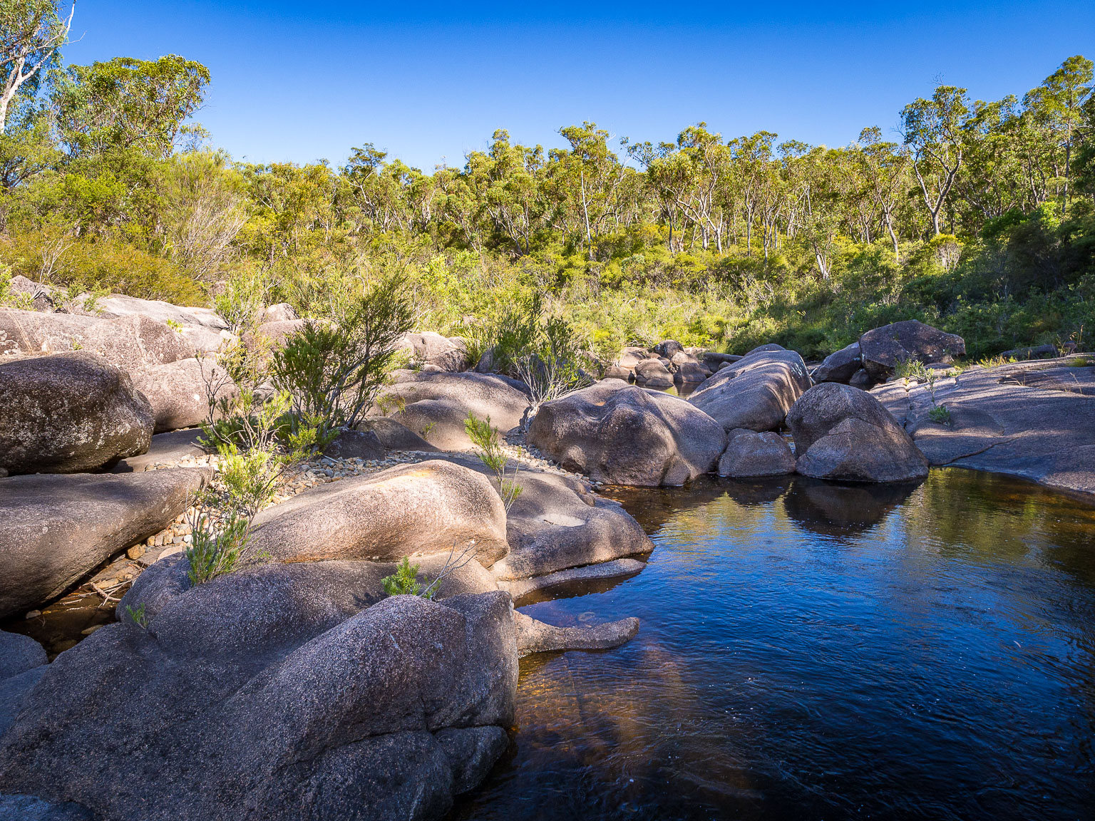
Bald Rock Creek Circuit is just as easy as the Granite Arch one; in fact, it’s probably an even easier stroll. The track takes you along the granite creekbed and rock pools—I find early morning or late afternoon best as the water in the rock pools will be calm with lovely reflections.

THE JUNCTION
The Junction At a Glance
The Junction is probably our favourite walk at Girraween.
It’s a fairly easy, mostly flat stroll that you can make as short or as long as you want. You can take a quick look around if you’re short on time or spend hours exploring the creekbed, the rock pools and the junction of Bald Rock Creek and Ramsay Creek at the western end.

The granite here shows massive swirls in the rock, and it’s equally as impressive on a sunny afternoon as it is on a cool, overcast morning. Just remember that if it’s wet, the granite can get slippery.
THE PYRAMID
The Pyramid At a Glance
While The Junction is our favourite walk, The Pyramid is definitely the most popular hike at Girraween. It’s a steep climb up a granite slope to a dome-shaped peak—not advisable when it’s wet—with a few painted track markers to guide your way.


At the top, you’ll be greeted by Balancing Rock, a massive granite boulder balancing precariously on a tiny edge, and expansive views over Girraween and surrounds.
The descent can feel a little dicey if you’re not sure-footed. There have been times when I’ve sat out this hike because I’ve felt a little too much vertigo even scaling up so make sure you’re feeling confident going up AND down.
SOUTHERN SECTION: TRAILS FROM CASTLE ROCK CAMPING AREA
Across the road from the Bald Rock Creek day-use area are the three camping areas. And that’s exactly where you’ll need to head to explore the southern trails.
There are two access walking tracks to the southern trailhead: One from the visitor centre and the other starting opposite the Bald Rock Creek day-use area (basically to the right of the camping areas). Alternatively, you can just walk through the camping areas if you can’t find the tracks.
You’ll find the southern trailhead right at the end of Castle Rock camping area (or a bit further along if you’ve taken the track from the visitor centre).
There’s no day visitor parking at the trailhead, park at the Bald Rock Creek day-use area or at the visitor centre, and then head along the access tracks to start these walks.
CASTLE ROCK
Castle Rock At a Glance
For a hike with sprawling views over the surrounding landscape, take the Castle Rock track up to its dome-shaped peak. It’s an easier trail than The Pyramid as you don’t have to scale up a sheer granite wall but you might still get your heart pumping towards the end before being rewarded with fantastic 360° panoramas and rock formations dotted in the distance.

Most of this track is through eucalypt woodland so it’s a good option on a hotter day as you’ll at least get some shade along the way.
THE SPHINX & TURTLE ROCK
The Sphinx & Turtle Rock At a Glance
If there’s any hike that’s overrated at Girraween, it’s this one. The track itself is fairly flat, there are some undulating sections but nothing too strenuous.


So while I can (just) get behind the rock formation called ‘The Sphinx’, Turtle Rock is a bit of a letdown. You can only make out the shape of a turtle from the air, and we all know how much of a drone fan I am. Plus, the track just ends and you can’t even get to Turtle Rock without a lot of bushbashing and scrambling through thick undergrowth (been there, done that but not worth the effort).
If you want the exercise, go for it; otherwise, this is one walk you could actually skip, especially if you’re short on time.
TRAILS FROM MOUNT NORMAN DAY-USE AREA
The Mount Norman day-use area is in the southern part of the national park.
If you’re in a 2WD vehicle, you can’t take the direct unsealed track across the park. Instead, you’ll need to exit back out to the New England Highway, drive south past Wallangarra before looping back into the southern end via Mount Norman Road.
In a 4WD, you can simply take the direct inland track (Mount Norman Road) that cuts straight across the park between the main section and the Mount Norman area—just note that it gets quite sandy.
MOUNT NORMAN
Mount Norman At a Glance
Mount Norman is the highest peak in Girraween National Park at 1,267m, though the very top of this peak is only suitable for rock climbers. But even if you can’t hike right to the top, you’ll still get magnificent views from the base. Plus, you can see the Eye of the Needle rock formation up close.


You can hike Mount Norman from two trailheads: For the longer option from the north, start from the Castle Rock camping area end (southern trailhead). Alternatively, head to the Mount Norman car park in the south to shorten it to a 4km hike across the granite slopes.
From the Mount Norman car park, this hike is a fairly straightforward affair but it is almost completely exposed so come prepared with a hat and all that. From the other end, the track starts in woodlands so you’ll get a bit more shade, at least initially.
EASTERN SECTION: TRAILS FROM DR ROBERTS CAR PARK
Past the visitor centre, the road becomes unsealed but it’s usually well-graded and you shouldn’t have any issues making it to the Dr Roberts car park in a standard 2WD vehicle.
DR ROBERTS WATERHOLE
Dr Roberts Waterhole At a Glance
This almost completely flat, wide track leads to a large waterhole of Bald Rock Creek; it’s a very easy stroll and great for families or if you have mobility issues.

If you come in spring, the wildflowers can be prolific along the track. I find early morning is best as the birds go a bit nuts and the reflections in the water tend to be calmer.
UNDERGROUND CREEK
Underground Creek At a Glance
If you want to see more granite rock up close, the Underground Creek scramble is fantastic. The track to the rock formation is an easy stroll but the fun really only begins once you start scrambling around the stripey boulders where Bald Rock Creek disappears underground.

You can easily spend an hour here scrambling between boulders, especially when water levels are low and you can climb up onto the rocky outcrop.
SHARED TRAILS AND REMOTE TRACKS
Girraween also has a couple of shared trails (cycling + walking) in less popular spots through woodland and with granite peaks rising in the distance. They both start about 3km past the Dr Roberts car park. If you’re cycling, you can easily combine the two tracks.
- Creek Circuit (3.5km loop): Shady track through woodland; lots of wildflowers during spring
- Peak Trail (10.6km one-way): More exposed than the Creek Circuit but also offers more views of the granite peaks, including Mount Norman; best done as a bike ride or with a car shuffle
Girraween also has plenty of fire trails if you’re keen on more remote overnight hiking. You’ll need a proper map of the area. I haven’t done any overnight hiking here as neither the husband nor I are that keen on trudging along fire management tracks or bushbash for hours on end (sorry, totally not a real adventurer). 🙂
READY TO HEAD OFF TO GIRRAWEEN?
Girraween features in almost all my roundups on South East Queensland because it is a really fantastic national park.
It’s got short walks, long walks, picnic areas, views, boulders for scrambling around, reasonable campsites, kangaroos galore, wildflowers in spring and summer, and plenty of birdlife. And you can stay closeby in Stanthorpe if you don’t fancy a camping mat and tent, and just come for the day.
What’s not to love? 🙂
Girraween Resources
Note: Check the park alerts before you head off—heavy rain or slippery granite can affect track safety, particularly on steep climbs like The Pyramid.
Happy hiking,



No Comments