Blackdown Tablelands National Park is on Ghungalu Country. I acknowledge the Traditional Custodians of this area and their deep and ongoing connection to Country, and pay my respects to their Elders past and present.
Blackdown Tableland National Park a relatively small national park in central Queensland but it delivers a whole lot more than what I had expected.
Even though the weather was a bit crummy over the two days we spent here, there’s enough unexpected beauty to delight (almost) anybody.
To get to Blackdown Tableland, you’ll first have to wind your way up a narrow road to a plateau. And then, almost like on a platter, you’re presented with such a varied landscape that it doesn’t seem to fit in with the surrounding dry Queensland country you gaze onto from the plateau.
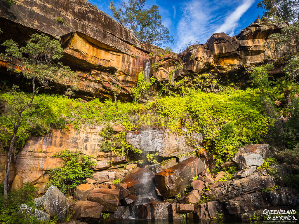
Blackdown Tableland is the traditional home of the Ghungalu, and you can appreciate some Ghungalu artefacts on one of the walks
BLACKDOWN TABLELAND NATIONAL PARK: TIPS FOR YOUR FIRST VISIT
Ideally, plan at least two days here, especially if you’re in a 4WD-vehicle and want to do the scenic drive around the park. We had two days and managed to squeeze almost everything in but if you like to take things a bit more leisurely, plan an extra day or so.
HOW TO GET TO BLACKDOWN TABLELAND
Blackdown Tableland National Park is a long way from Brisbane, about 830km or at least a 9-hour drive. Unless you live in Central Queensland, you’ll probably visit Blackdown Tableland as part of a longer road trip.
From Rockhampton, it’s about 180km inland along the Capricorn Highway. If you’re coming from the west, Emerald is about 110km west of Blackdown Tableland.
The turnoff (Charlevue Road) from the Capricorn Highway to the national park is about 10km past Dingo (coming from the coast), you can’t really miss it.
Signage to the park is excellent and there really is only one road once you turn off from the Capricorn Highway.
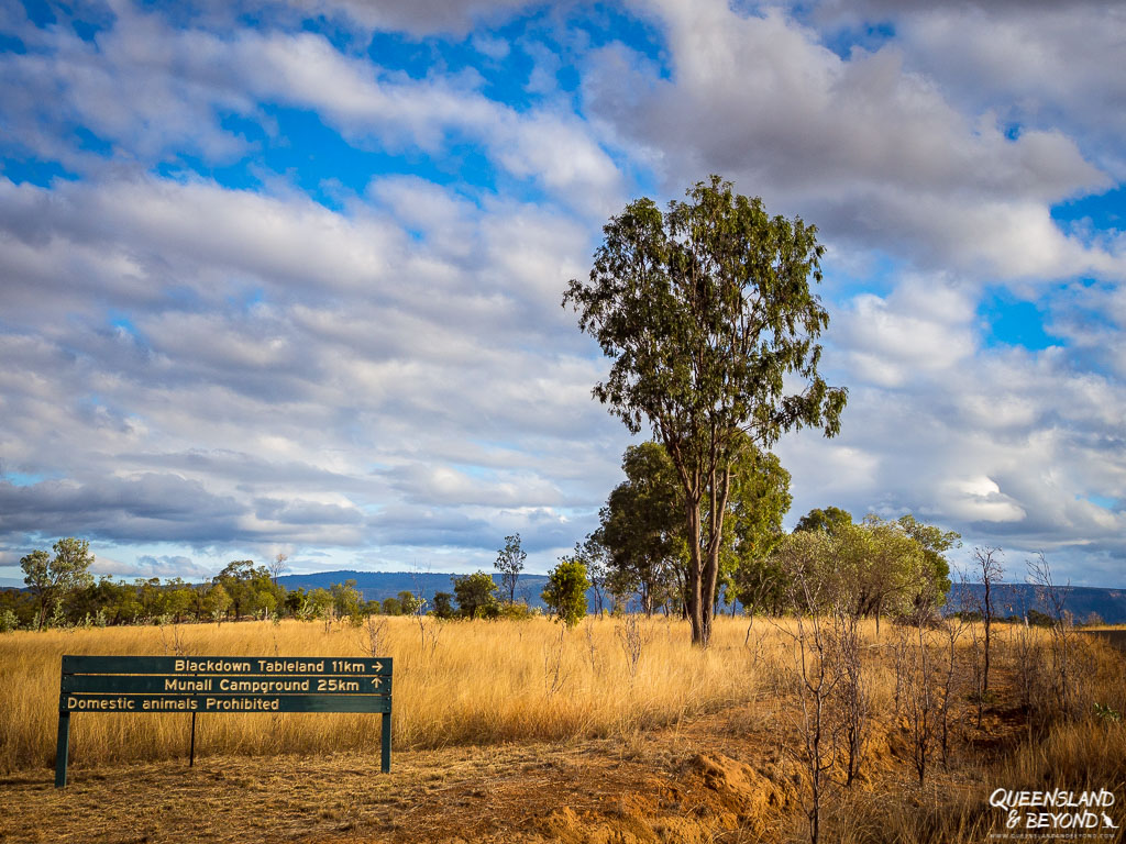
The road up the plateau is quite narrow and steep. While it is completely paved, it’s unsuitable for large motorhomes or caravans as they may struggle to get around the switchbacks.
Past the entrance, the road becomes unsealed and is usually 2WD-accessible all the way to the campground. The scenic loop drive is 4WD-only.
WHEN TO VISIT BLACKDOWN TABLELAND
Blackdown Tableland was the first stop on one of our winter Queensland road trips, and not surprisingly, the weather was on the cold(er) side.
In winter, expect a maximum of 20°C during the day (probably more like 15°C), and cold nights since you’re high up. Bring warm clothes if visiting in the colder months of the year.
Being up high up, and coupled with Blackdown Tableland having its own special eco-system, we found ourselves camping in fog, mud and intermittent drizzle. It somehow added to the atmosphere though I’m sure it’s equally splendid on a blue sky day.

You may want to avoid summer as even up on the plateau, the temperatures can be steamy. But Blackdown Tableland is also cooler than the surrounding plains so you might find it bearable.
Expect temperatures in the high 20°Cs to low 30°Cs. Just make sure you bring sufficient water since there is none in the park.
WHERE TO CAMP AT BLACKDOWN TABLELAND
There aren’t a lot of options for camping in and around Blackdown Tableland.
The obvious choice is to camp in the national park itself, though if you’re there in winter, the experience might be a rather wet one.
There is only one camping area (Munall camping area) at Blackdown Tableland. There are two loops, with the second loop only suitable for 4WD vehicles.

Camping here is very basic and that pretty much means there are just a couple of drop toilets available. There is no water at Blackdown Tableland so come prepared. Ensure you’re camping responsibly.
Your other options include staying at the caravan park in Dingo (about 30km) or even Emerald (about 100km) if you prefer access to more amenities or don’t want to drag your caravan up the steep hill.
3 THINGS TO SEE AND DO AT BLACKDOWN TABLELAND
The abundant vegetation and scenery at Blackdown Tableland really surprises you.
You’ve got everything from giant ferns, stunningly green mosses, dry eucalypt forest, clear creeks, sandstone gorges, rock pools, waterfalls to sweeping views into the surrounding plains.
Together with the short walks and Ghungalu rock art, Blackdown Tableland makes for a very special little stop for anyone who likes a dose of nature and history.
1. VIEW ABORIGINAL ROCK ART
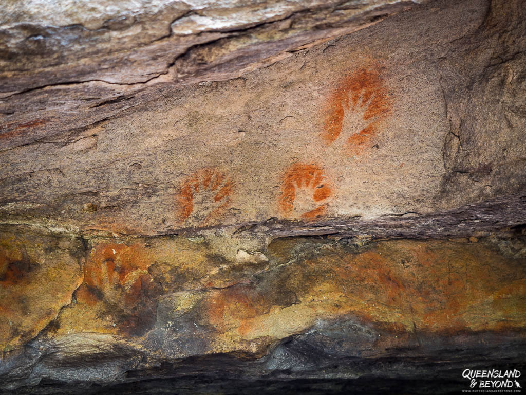
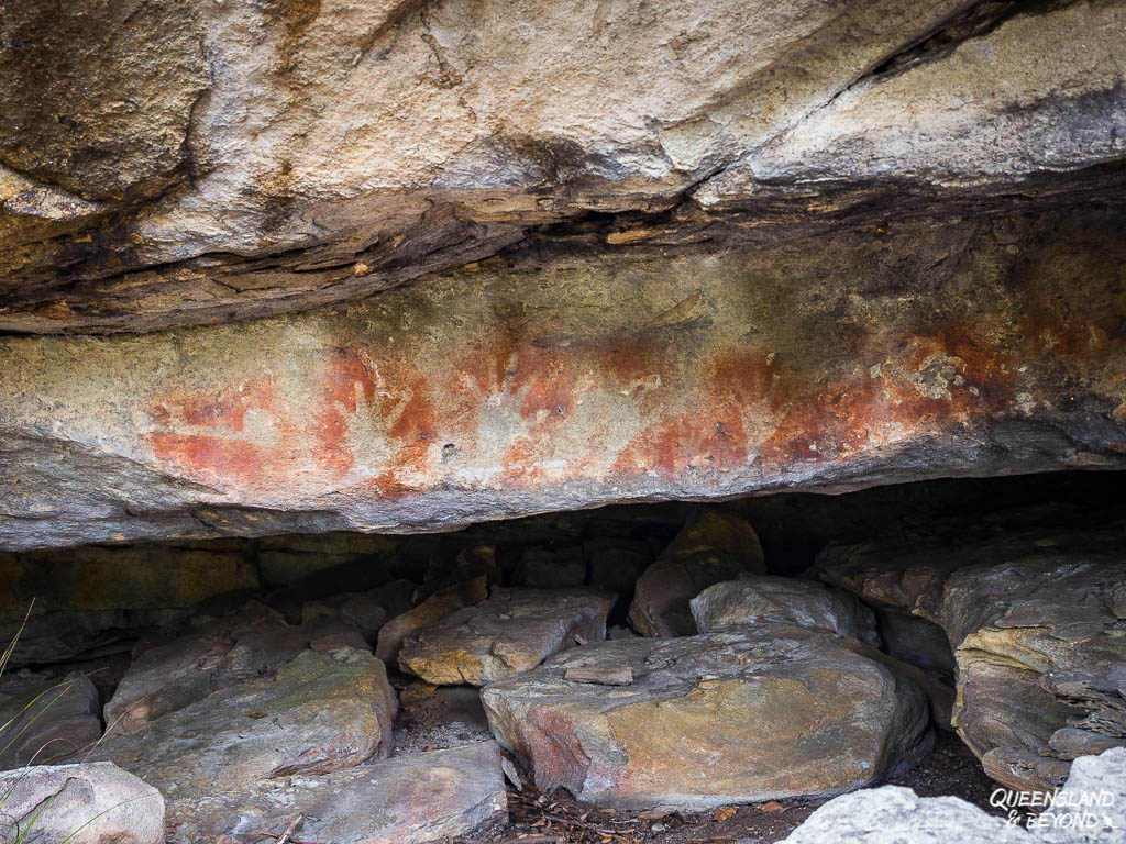
Blackdown Tableland doesn’t have the vivid colours of the rock art at Carnarvon National Park but you can still find some excellent, albeit small, examples of rock art at the Ghungalu art site.
Like at any indigenous site, be respectful and leave the artwork alone.
2. TAKE SHORT WALKS AND ADMIRE THE LOOKOUTS
There are only a few short walks at Blackdown Tableland but they’re all worthwhile. Gudda Gumoo Gorge is the standout but I also really enjoyed our morning walk to Mook Mook.
1. GUDDA GUMOO LOOKOUT & GORGE (RAINBOW FALLS)
BASIC TRAIL INFO

DISTANCE: 4km return (3.6km return to lookout only)
DIFFICULTY: Grade 4 (moderate)
TIME: 1.5-2 hours
TRAILHEAD: Car park along the national park road (past the camping area)
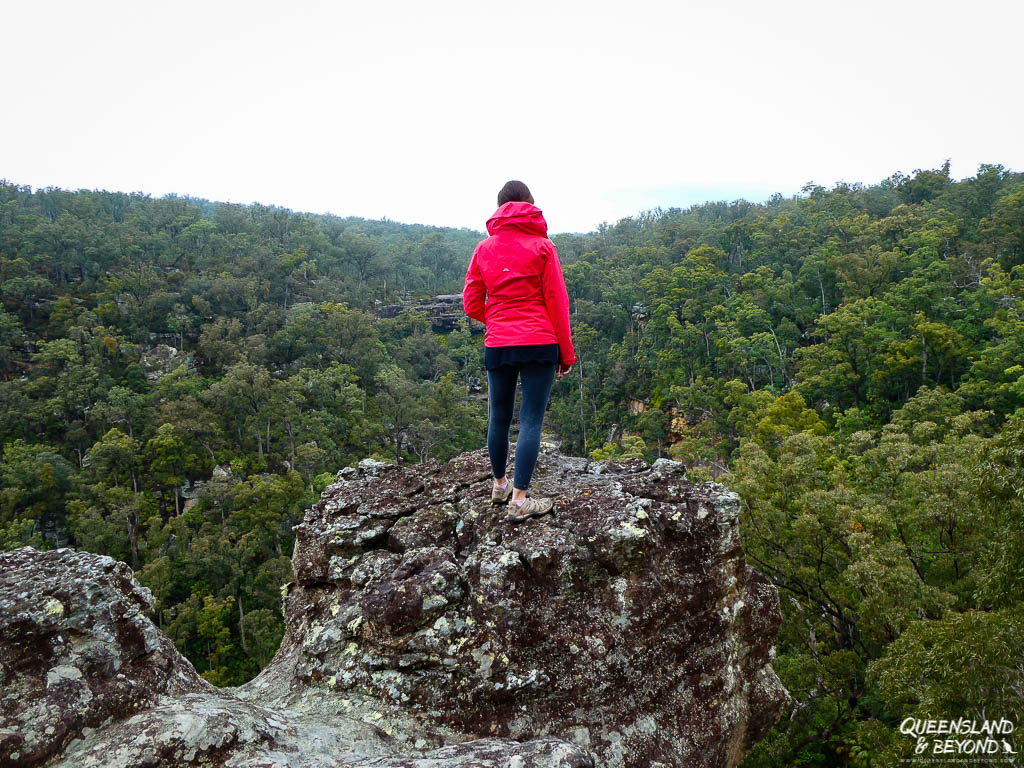
Gudda Gumoo Gorge is, no doubt, the highlight at Blackdown Tableland.
The walk leads into a gorge abundant in fern fronds. At the base is a clear (and cold) rock pool fed by a trickling waterfall that reflects a shimmering rainbow when the light shines just right.

The walk is classified as moderate and yes, you’ll have to head down over 240 (more or less slippery) stairs to get to the base but that’s as difficult as it gets.
If that sounds too daunting, you could just head to the lookout and leave it there. You won’t see much of Rainbow Falls but you do get some views into the lush sandstone gorge and cliffs.


The Gudda Gumoo area is of a deep cultural significance to the local Aboriginal people so respect the area.
We spent about three hours on this walk, scrambling around rocks and exploring the gorge. It is a really beautiful and tranquil spot.
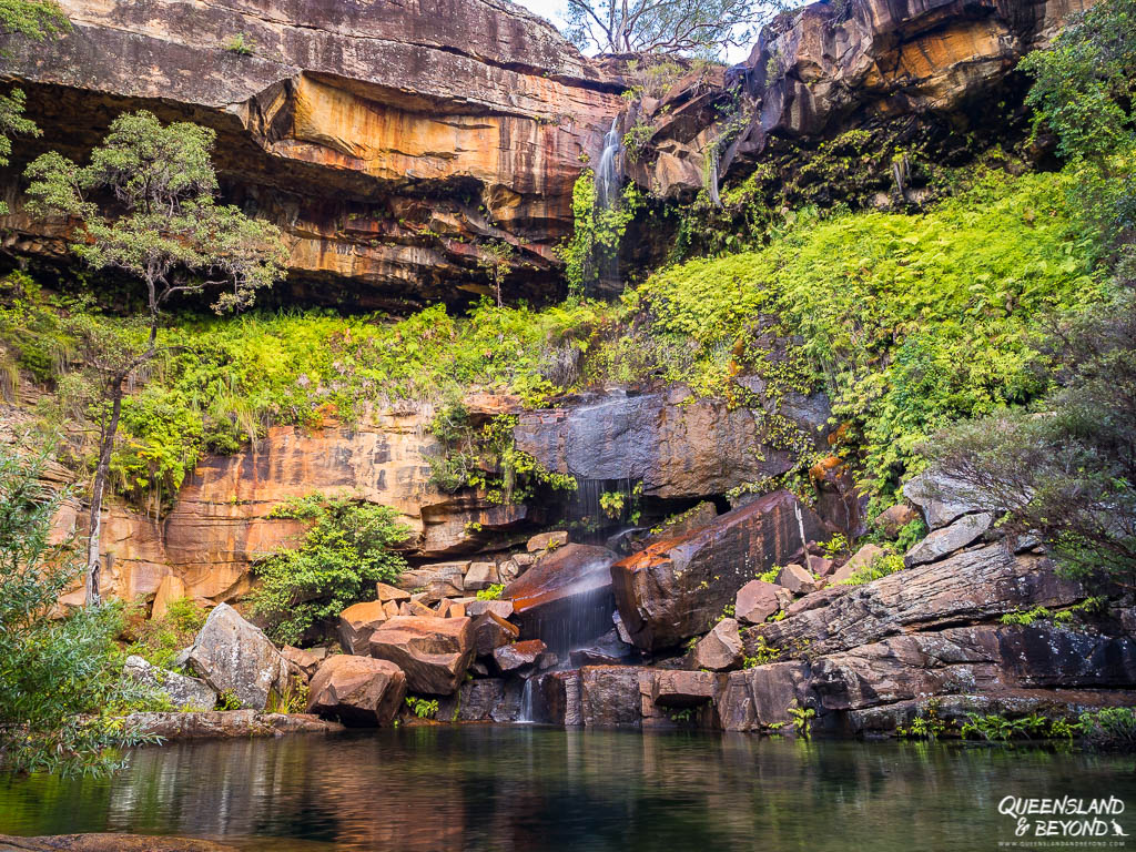


You’re not supposed to jump in the rock pool for cultural reasons. But I expect that it might be quite busy in summer as people seek to escape the heat.
2. MOOK MOOK
BASIC TRAIL INFO

DISTANCE: 2.4km return
DIFFICULTY: Grade 3 (easy)
TIME: less than 1 hour
TRAILHEAD: Eastern end of the camping area (opposite the entrance to the camping area)
The trail to Mook Mook Lookout is quite a pleasant little walk that starts along Mimosa Creek before crossing it. You end up at a lookout opening up into a sweeping gorge flanked by sandstone cliffs.
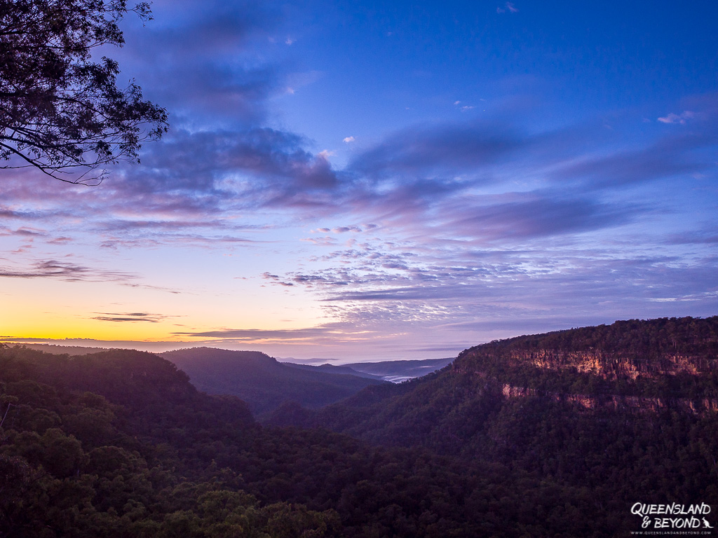
I figured Mook Mook would make for a great sunrise spot, and yes, while that’s technically true, the sunrise wasn’t as spectacular as it could have been. The sun creeping over the cliffs and basking them in splendid orange light was pretty stunning though.
3. GOON GOON DHINA
BASIC TRAIL INFO

DISTANCE: 2.5km loop
DIFFICULTY: Grade 3 (easy)
TIME: 0.5-1 hour
TRAILHEAD: Western end of the camping area
Goon Goon Dhina is an easy loop with plenty of interpretative signs along the way.
It starts at the end of the camping area and takes you into a forest full of orange stringybarks, across Mimosa Creek and to the Ghungalu art site. Near the start, you can also see some remnants of an old cattle yard, evidence that this area was used as grazing country around the turn of the century.

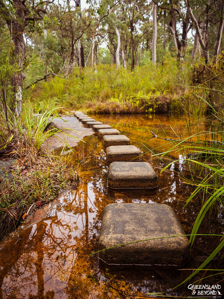


Don’t expect too much from the cattle yard though. There are really only a few traditional fence posts left that hint at a time when fencing was done entirely without wire.
4. GOODELA
BASIC TRAIL INFO

DISTANCE: 3.6km return
DIFFICULTY: Grade 3 (easy)
TIME: 1 hour
TRAILHEAD: Near the entrance to the national park (day-use area)
Goodela is another easy forest walk but along the escarpment at Blackdown Tableland.
Unfortunately, we ran out of time for doing this walk so I’m not sure whether it’s worth or not.

5. YADDAMEN DHINA
BASIC TRAIL INFO

DISTANCE: 200m return
DIFFICULTY: Grade 2 (very easy)
TIME: 5 min
TRAILHEAD: Near the entrance to the national park (day-use area)
Yaddamin Dhina starts from the same day-use area as the Goodela track right at the entrance.
It’s only 100m (one-way) so won’t take much time at all. But you could also combine this with a picnic at the day-use area (picnic tables and gas bbq available).

The track leads to a lookout over the escarpment, and though we had hazy views, looking into the plains beyond with cliffs to one side wasn’t too shabby.
3. TAKE A SCENIC DRIVE (4WD-ONLY)
If you’re in a 4WD-vehicle, you could also do the 19km scenic loop drive.
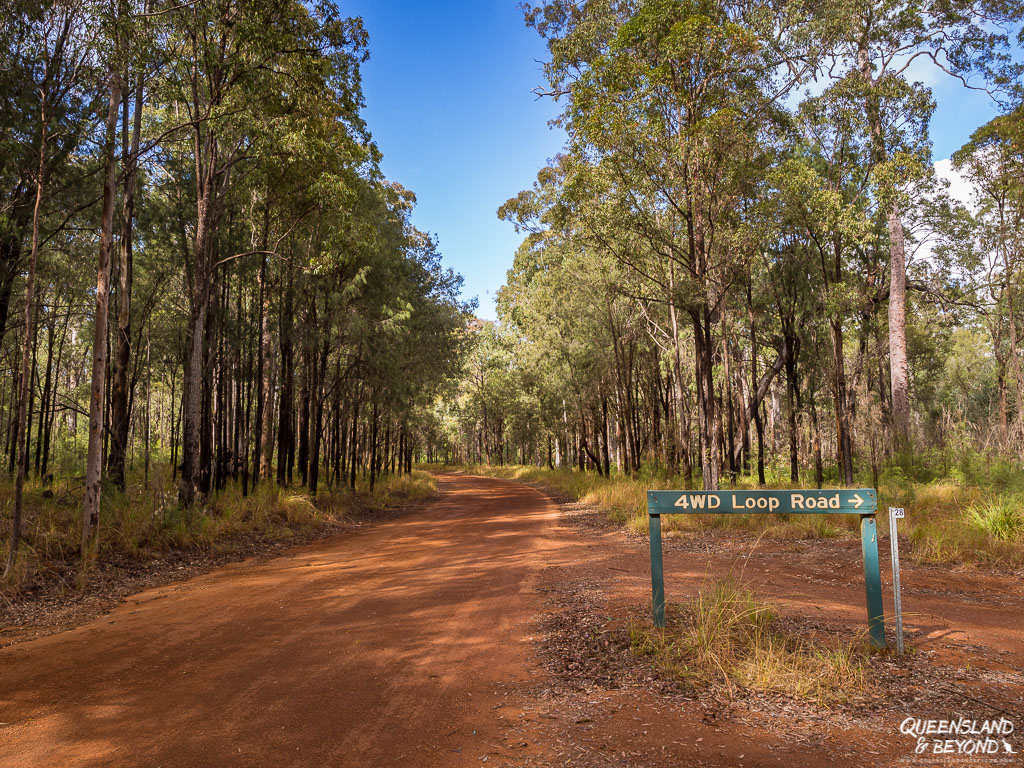
It’s touted as a scenic drive but we didn’t really find it that scenic.
The track leads mostly through dry forest with almost no views, except for Mitha Boongulla (Charlevue Lookout) about half-way along. By the time we got there though, it was fairly hazy so views weren’t that exciting.
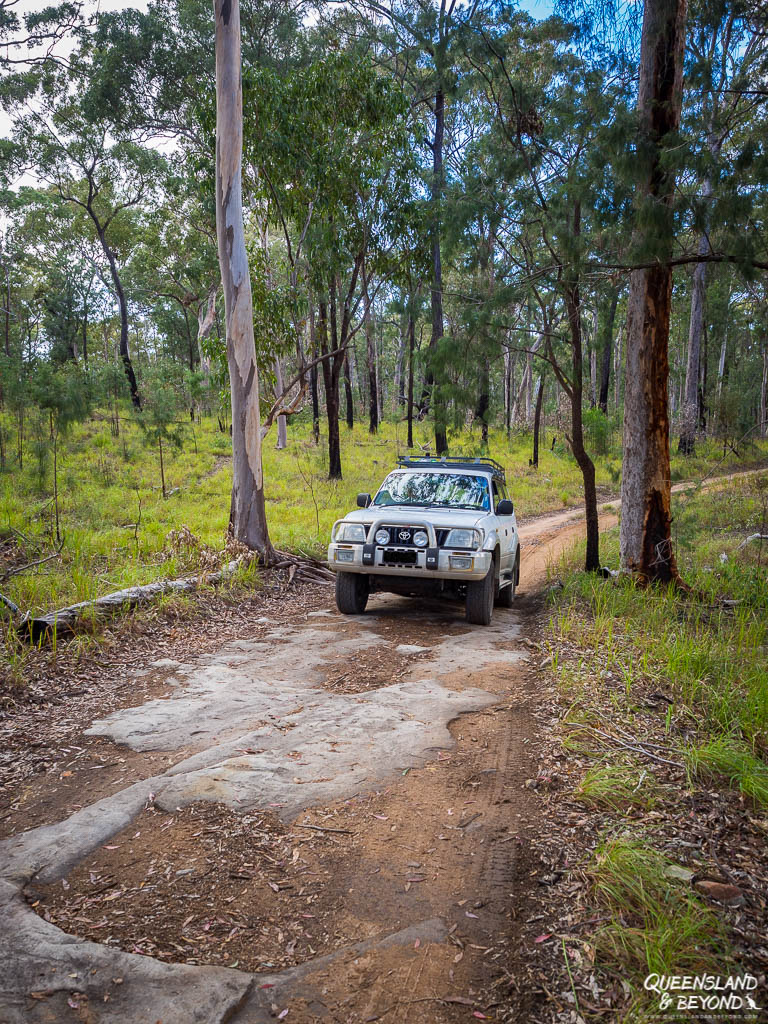


It probably took us just under a couple of hours to do the drive so if you’re short on time, give this one a miss.
FINAL THOUGHTS
Blackdown Tableland is an unexpected little gem in Central Queensland.
I didn’t expect Rainbow Waters (Gudda Gumoo) Gorge to be as serene and stunningly beautiful as it was, and really quite enjoyed all the walks. The views around Gudda Gumoo, both from down the gorge at the rock pool and from above, were brilliant and if you’re a bit of rock scrambler, plan more than 1.5 hours to do this walk.
In winter, Blackdown Tableland can be fairly foggy, drizzly and cool, though the sun did try and poke through here and there.
If you’ve been to Blackdown Tableland, let me know in the comments below what you think!
Happy exploring,

MORE INFORMATION
Camping options are mostly limited to camping at Munall camping area. Read more about what to expect in my camping guide.
You can find a map of Blackdown Tableland here. For more information, including details on current park alerts (e.g. fire bans), check Queensland Parks & Wildlife Service.
MORE POSTS ON ROCK ART IN CENTRAL QUEENSLAND
Aboriginal rock art is pretty special and there are quite a few places in Central Queensland where you can get a glimpse.
In Central Queensland, try Carnarvon Gorge for some stunning examples or the Mount Moffatt section of Carnarvon National Park. You can see very vivid artefacts here, including stencils of a kookaburra and the remains of burial chambers.
Another place is Cania Gorge, which has a giant foot print.
Rungulla National Park in the Gulf Savannah region has a small rock overhang with handprints and some other painted artefacts.
SAVE TO PINTEREST



2 Comments
Spophy
4 November 2019 at 2:24 AMHach sieht das da idyllisch aus, die Walks sind bestimmt toll. Und der Kokaboora ist ja soo flauschig x)
Kati
4 November 2019 at 12:32 PMWenn man vom Nebel abgesehen hat, war es wirklich sehr schoen. Und jaaa, die Kookis!!!! <3