
This post contains affiliate links. If you buy something through these links, I may earn a small commission at no extra cost to you. I only recommend gear I’ve actually used out on the trails and really loved! Read my full disclaimer.
I acknowledge the Kabi Kabi and the Jinibara peoples as the Traditional Custodians whose lands and waters we all now share on the Sunshine Coast. I pay my respects to their Elders past and present.
It may not be immediately obvious but the Sunshine Coast does have quite a selection of short and longer trails if you know where to look.
And even though the Sunshine Coast might be more limited in the ‘long hike department’ compared to the Gold Coast Hinterland with its unending supply of hiking trails of all sizes, we still have a few excellent day walks on offer.

The best time to hike these longer trails is during the winter months: Cooler temperatures, less humidity and far fewer mozzies and leeches in the rainforest. But whether you’re heading into the rainforest or along the coastline, here are a few things I generally have with me for a longer day on the trail.
Day Walk Essentials
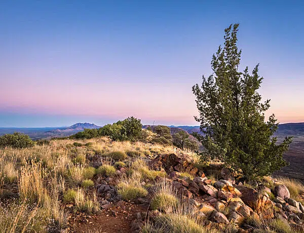
FORESTS, FARMLAND AND A BIT OF COAST: LONG(ER) DAY HIKES ON THE SUNSHINE COAST
Most of the longer bushwalks are in the Sunshine Coast Hinterland but you can also head to Noosa National Park for a coastal experience if you want a break from the rainforest.
Many of these longer hikes are shortish half-day hikes that will take you around 1.5 to 3 hours to complete. However, there a couple of full-day options as well—and if you combine your walk with a picnic, it makes for a nice day out, I reckon. 🙂
Here are some of my favourite long(er) day hikes (anything over 5km), organised from north to south.
1. KIN KIN COUNTRYSIDE LOOP | KIN KIN
Kin Kin Countryside Loop At a Glance
The Kin Kin Countryside Loop is part of the Noosa Trail Network and starts, not surprisingly, in the small town of Kin Kin.


The elevation profile looks very flat but there are a couple of small hills to tackle along the way. That said, it’s a great walk to do if you’ve got knee problems or simply feel like more of a relaxing day hike.
You start and finish in the town of Kin Kin, and in-between loop around local farmland, parks, dry forest and along a few rural roads.
The route is generally well-marked (follow track marker #1) though some sections can get overgrown. You’ll get great views over the countryside early in the hike and again as you near Kin Kin at the end of the loop.
2. ARTIST CASCADES | CONONDALE NATIONAL PARK
Artist Cascades At a Glance
The Artists Cascades track is only accessible by 4WD since you will need to cross Booloumba Creek three times to reach the day-use area. The crossings are usually pretty shallow but the creek bed is quite rocky.

The track starts opposite the day-use area and meanders entirely through the rainforest. It can be leech-infested, especially after a bit of rain.
Booloumba Creek can be super busy but there are usually far fewer people on the trail. This track forms part of the Conondale Range Great Walk so you could keep going past Artists Cascades if you felt so inclined.
The trail itself is relatively flat if mildly undulating at times. You can take a couple of side trips to the Strangler Cairn sculpture or the old Gold Mine shaft—neither of them are particularly fascinating though.


Artists Cascades itself is a beautiful spot where the river valley opens up around you. The water is refreshing and the rock pool is generally safe for a swim.
3. NOOSA COASTAL TRACK | NOOSA NATIONAL PARK
Noosa Coastal Track At a Glance
The Noosa Coastal Track is one of the most popular trails on the Sunshine Coast, and on a sunny day, you will be sharing it with tons of people—for good reason.
Noosa National Park is a gorgeous coastal stretch with a path that winds around coves, up onto cliffs and across beaches.

If you want to walk the full length, I suggest starting from the Sunshine Beach end. This gives you a great cardio workout up the initial stairs, and can make it slightly easier to find a parking spot than at the main Noosa carpark.
You can either walk along the coast and return the same way, or turn the hike into a loop by heading back via the inland Tanglewood Track or Noosa Hill Track and using connector walking tracks back to the start at Sunshine Beach (or vice versa).
Want to know the details? The Noosa Coastal Track requires a bit of planning to avoid the crowds. You can read my full guide to the Noosa Coastal Track for a detailed look at the trail conditions, wildlife spots and return route options.
4. BORONIA-LITTORALIS LOOP | MOOLOOLAH RIVER NATIONAL PARK
Boronia-Littoralis Loop At a Glance
The Boronia-Littoralis Loop at Mooloolah River National Park (no, it’s not actually along the river) isn’t a hugely popular walk, but I keep coming back because I love the gorgeous coastal heath, shrubland and scribbly gums here.


You can start at either trailhead and then loop from the Boronia trail onto the Littoralis trail (which connects into Aemula trail), or vice versa.

Unfortunately, you can hear traffic noise from the nearby motorway at times but I still really enjoy this walk for some fresh air and exercise.
The track is very exposed so it’s best to avoid the heat of summer or go early or late in the day. It can also get very muddy during the wet season or after heavy rain.
5. KUREELPA FALLS CIRCUIT | MAPLETON NATIONAL PARK
Kureelpa Falls Circuit At a Glance
The Kureelpa Falls Circuit is a shared-use trail in Mapleton National Park, so you might see mountain bikers or horse riders along the way.
While the hike through dry sclerophyll forest is not the most scenic, the loop is well worth it for the fabulous Kureelpa Falls half way along.
The falls are splendid after some rain but even when they’re drier, the rock scrambling and exploring you can do around the creek area makes for a nice break from the trail. Just be careful around the cliffs as the drop into the gorge is steep.


The track itself is on the rougher side and mostly feels like a fire management track or maintenance road. It’s not steep but there is some drop in elevation down to the falls.
Side note: If you only want to see Kureelpa Falls, you can short-circuit it by taking Kureelpa Falls Road, parking right at the end and taking the goat track across the creek. Not recommended though.
ALONG THE SUNSHINE COAST HINTERLAND GREAT WALK: OPTIONS FOR DAY HIKES
The entire Sunshine Coast Hinterland Great Walk is 59km typically spread over 3-4 days.
However, several access points make it easy to tackle smaller sections of it, whether as an overnight hike or half/full-day hikes.
The full route traverses the Blackall Ranges from Baroon Pocket Dam (near Maleny) through Kondalilla and Mapleton National Parks, finishing with a loop through the Gheerulla Valley.
You can slice and dice the great walk in so many different ways—it’s really up to you where you want to start and how far you want to walk.
Here are a few suggestions to get you started.
6. GHEERULLA FALLS | MAPLETON NATIONAL PARK
Gheerulla Falls At a Glance
Gheerulla Falls is accessible from a few different starting points, meaning you can do this as a quick return hike or a longer loop.
For a longer hike, start at the Leafy Lane trailhead and follow the signs to the Sunshine Coast Hinterland Great Walk. Once you join the Great Walk, follow the signs all the way to Gheerulla Falls.
The Ubajee Viewpoint, just past the Ubajee walkers camp, is a great stop for a break or lunch before returning the same way.

The track is great for a sunny day as it’s mostly through forest. It involves a bit of a descent on the way to Gheerulla Falls as you climb down the escarpment and into Gheerulla Valley. And that naturally means a nice uphill climb as you make your way back.
For a much easier option, start at the gated entrance further along Delicia Road. Note that this gate is not the main Delicia Road trailhead (M4)—keep driving past until you see a small sign for Gheerulla Falls / Great Walk on your right. There is no formal carpark here, so just pull off the road.
From this entrance, the walk is a relatively flat 3km return.
Chasing more cascades? If you want to find more creeks and waterfalls across the region, check out my guide to the Sunshine Coast’s best waterfalls.
7. GHEERULLA VALLEY VIEWPOINT | MAPLETON NATIONAL PARK
Gheerulla Valley Viewpoint At a Glance
The hike to Gheerulla Valley Viewpoint takes you to a rocky, open lookout over the valley.
Start at the gated entrance to Mapleton National Park along Delicia Road. Note that this is not the main Delicia Road trailhead (M4) but a gate further along after the road turns to gravel. There is no formal parking area so just look out for the gate and pull of the road near the national park signs.
From the gate, head towards Thilba Thalba walkers camp. Make sure you don’t take the track towards Gheerulla Falls or you’ll end up doing the entire circuit and take a long time to get the lookout!

The track is mildly undulating if somewhat uphill to the lookout. Gheerulla Valley Viewpoint is a lovely spot for a break or lunch as you can get some pretty views down into the valley while you enjoy your picnic. Just take care around the cliffs, the area is unfenced.
8. MAPLETON FALLS TO UBAJEE VIEWPOINT | MAPLETON FALLS / MAPLETON NATIONAL PARK
Ubajee Viewpoint At a Glance
Another great option for a day hike is to start at Mapleton Falls (M3 trailhead) and walk to Ubajee Viewpoint and back. It’s a mostly flat track and very easy to navigate.

Just park at the Mapleton Falls day-use area, head onto Wompoo Circuit and follow the Great Walk signs toward Ubajee walkers camp. The lookout is some hundred meters past the camping area and features a nice bench for a lunch break. Return the same way.
9. SUNSHINE COAST HINTERLAND GREAT WALK: GHEERULLA CIRCUIT | MAPLETON NATIONAL PARK
Gheerulla Circuit (Great Walk Loop) At a Glance
If you want to do an overnight hike, the circuit section of the Sunshine Coast Hinterland Great Walk is a great option. You can start at the Leafy Lane carpark, or from the Mapleton day-use area if you want to add an extra kilometre to the hike.
The trail heads past Ubajee walkers camp before dropping into the Gheerulla Valley. From there, follow Gheerulla Creek for a stretch before climbing back up onto the ridge where the Thilba Thalba camping area is located.

You could do the entire loop in a day if 35km means nothing to you. But if 35km sounds like quite the distance, you can do it as a more leisurely overnight hike by camping at the Thilba Thalba walkers camp.

The panoramic lookout at the camping area feels like a pretty nice reward after the hard work of climbing onto the ridge.
The next day, continue your hike by hiking towards Delicia Road, passing Gheerulla Falls and heading back up to Ubajee to return to Leafy Lane.
10. BAROON POCKET DAM—KONDALILLA FALLS | KONDALILLA NATIONAL PARK
Baroon Pocket Dam to Kondalilla Falls At a Glance
This track follows the first (or last) section of the Sunshine Coast Hinterland Great Walk and involves a fairly steep section down to Obi Obi Creek.
You get some fantastic views of Obi Obi Gorge from Obi Obi Lookout and Baroon Lookout before meandering through the rainforest to Kondalilla.

Obviously you don’t have to walk as far as the day-use area in Kondalilla, you could turn around whenever you want.
VOLCANIC OUTCROPS, DAMS AND HISTORIC TRAILS: DAY HIKES IN THE SOUTHERN HINTERLAND
The southern Sunshine Coast hinterland also offers a few day hikes, some of which are very much local trails and hardly ever visited by ‘tourists’.
Planning your Sunshine Coast itinerary? You can easily connect several of these hinterland trailheads by car using my guides to the Blackall Ranges and Glass House Mountains, making it simple to hop between the national parks over a long weekend.
11. EWEN MADDOCK DAM MAIN TRACK | MOOLOOLAH
Ewen Maddock Dam At a Glance
The Main Track at Ewen Maddock Dam starts at Maddock Park, mostly follows the lakeshore before eventually ending at Gympie Street North.

Because this is a shared trail with a fair bit of horse-riding and mountain biking, you’ll want to keep a sharp lookout for other trail users.
Since it’s a one-way track, you’ll either need to organise a car shuttle at the Gympie Street North end (7.7km) or walk back the same way (15.4km). Of course, you can always just turn around sooner if you want a shorter walk.
There are also a few side loops (max. 1km each) that you can add on for a longer hike. A great option is actually to walk out to one of these loop tracks and use it as your turnaround point.
12. ROSES CIRCUIT | DULARCHA NATIONAL PARK
Roses Circuit At a Glance
The Roses Circuit is a fantastic training hike for uphill or downhill fitness.
The tunnel section is straightforward and flat but the moment you start the Roses Circuit track, it’s steady uphill until you reach the Old Maleny Road exit. From there, you get a brief flatter section only to descend all the way back to the historic railway tunnel.


The trail runs through dry sclerophyll forest and isn’t particularly scenic but in terms of exercise and getting your heart rate up, it’s hard to beat.


Just keep in mind that all trails in Dularcha are shared: There’s a fair bit of mountain biking here so stay alert for other users (even though they should be giving way to you).
13. TRACHYTE CIRCUIT | GLASS HOUSE MOUNTAINS NATIONAL PARK
Trachyte Circuit At a Glance
Both the Tibrogargan and the Trachyte Circuits have had a makeover in recent years with part of the Trachyte Circuit has been re-routed so that it’s now slightly shorter than it used to be.
The Trachyte Circuit is a fairly easy trail; there only are a couple of uphill-ish sections but it’s flat and easy walking for the most part.
Jack Ferris Lookout is a definite highlight, offering views of Mount Beerwah and Mount Tibrogargan. On a clear day, you may even glimpse Caloundra in the far distance.

If you want a longer walk, you can tag the Tibrogargan Circuit onto the beginning or end of your hike and combine the two loops. This adds about 3km, bringing the total to roughly 9km. The shorter Tibrogargan Circuit is the more popular track of the two so expect a bit more foot traffic there.
Personally, I prefer the Trachyte Circuit because you get excellent views of Mount Tibrogargan, and the scenery feels a bit more interesting.
14. YUL-YAN-MAN TRACK | GLASS HOUSE MOUNTAINS NATIONAL PARK
Yul-Yan-Man Track At a Glance
The Yul-Yan-Man Track is officially rated as a difficult (Grade 5) track but if you’ve got some hiking experience and are comfortable with rock scrambling, you should be fine.
Starting from the Beerburrum carpark, the track climbs very quickly, involving big boulders as you sidle past Mount Beerburrum. You’ll get some lovely views of the Glass House Mountains as you reach the bluff.


From there, you have to scramble down an exposed rock face so definitely don’t attempt this hike on a rainy day.
To turn it into a loop, take the Soldier Settlers Trail at the end to return to your starting point. Because this is a shared trail, it’s wide and makes for easy walking. Just keep in mind that the entire route is fairly exposed and can be quite strenuous on a hot day.
MORE OPTIONS FOR HIKING TRAILS
There are a few more hiking trails longer than 5km on the coast but they’re not necessarily my go-to ones. But of course, it’s also nice to try somewhere different.
- Piccabeen Circuit (6.7km loop) | Mapleton National Park: A shared trail through blackbutt forest. You’ll have to cross Gheerulla Creek a few times.
- Booloumba Creek to Mount Allan (11km return) | Conondale National Park: Starting from Booloumba Creek day-use area, this track follows the Conondale Great Walk to the fire tower at Mount Allan and offers great views into the valley.
MAP OF HIKING TRAIL LOCATIONS
READY TO START HIKING?
At first it might seem like there aren’t that many hiking trails on the Sunshine Coast but you can actually find plenty once you start looking a bit more.
Most of the longer Sunshine Coast walking trails are in the hinterland but there are also a few trails around Noosa as part of the Noosa Trail Network.
Exploring on a budget? Outdoor trails are one of the best ways to explore the region without spending a cent. For more cost-free itinerary ideas, take a look at my guide to free things to do on the Sunshine Coast.
Let me know in the comments if I’ve missed a particularly wonderful hike on the coast, and I’ll be super happy to go check it out! 
Happy hiking,

SAVE TO PINTEREST


5 Comments
Joshua
12 June 2021 at 9:09 AMHey Kati! Great to read a full local guide with proper breakdowns on specific areas which was lacking in the other hiking guides I read. I think quite a bit of work went into writing this up, so thank you! 🙂 Looking forward to ticking a few of these off my list this winter.
Kati
7 August 2021 at 9:31 AMHi Joshua,
Sorry for the very slow response, I’m just catching up after a trip to Central Australia.
Thanks heaps for your feedback, I really really appreciate it! I spend far too much time writing up my lists (I’m probably just slow :D) so I’m super stoked to hear that you found this one helpful. I’ve got a few more to add but haven’t had time to update the post or write another one. Some time soon maybe…
Zach
13 September 2021 at 9:12 AMSuch a great article. Thorough, technical information along with photos and your personal perspective – gives a great impression of each trail. Much appreciated, Kati.
Tara
16 October 2022 at 7:19 AMThis is really helpful. I’ve been looking everywhere for more info on longer hikes. Thanks for all the work you’ve put in.
Kati
16 October 2022 at 10:53 AMHi Tara,
That’s great! 🙂 I found it a bit confusing too trying to get info on various hiking options on the coast so this is my own reference list as well. 🙂 Happy hiking.