Carnarvon Gorge is on Bidjara and Karingal Country. I acknowledge the Traditional Custodians of this special area and their deep connection to Country, and pay my respects to their Elders past and present.
Before moving to Queensland in 2013, I’d never even heard of Carnarvon Gorge.
So imagine my surprise when I encountered lots of interstate, and what’s more, international visitors who knew all about it. To be fair though, some Queenslanders I’ve asked about Carnarvon Gorge hadn’t heard about it either.
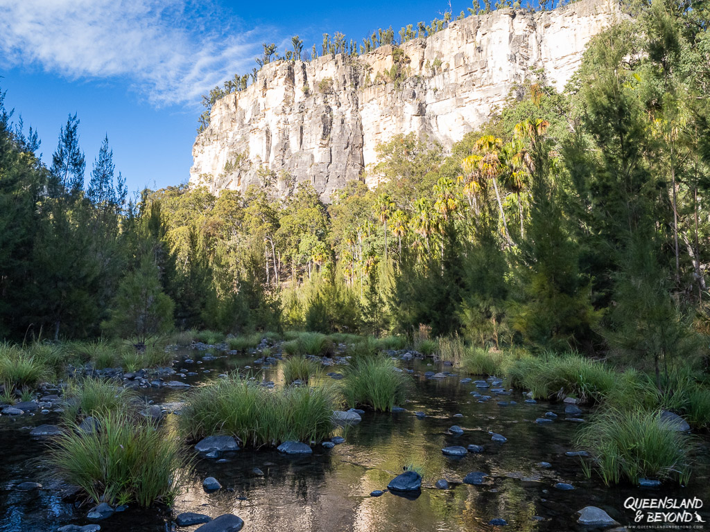
We’ve been to Carnarvon Gorge at least a couple of times. It makes for a spectacular stop on any Central Queensland road trip.
Disclaimer: This post contains a few affiliate links.
EXPLORING CARNARVON GORGE: TIPS FOR YOUR FIRST VISIT
Carnarvon Gorge is one of five (accessible) sections of Carnarvon National Park in the Central Queensland highlands.
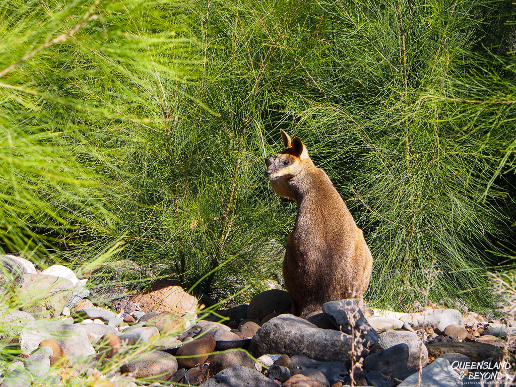
With its towering white sandstone cliffs, gorgeous lush vegetation, creeks, abundant wildlife, and stunningly preserved Aboriginal rock art, it’s probably the most spectacular section of the national park.
Carnarvon Gorge is a landscape with significant cultural history and connection to the land for the Aboriginal Traditional Custodians, the local Bidjara and Karingal groups.
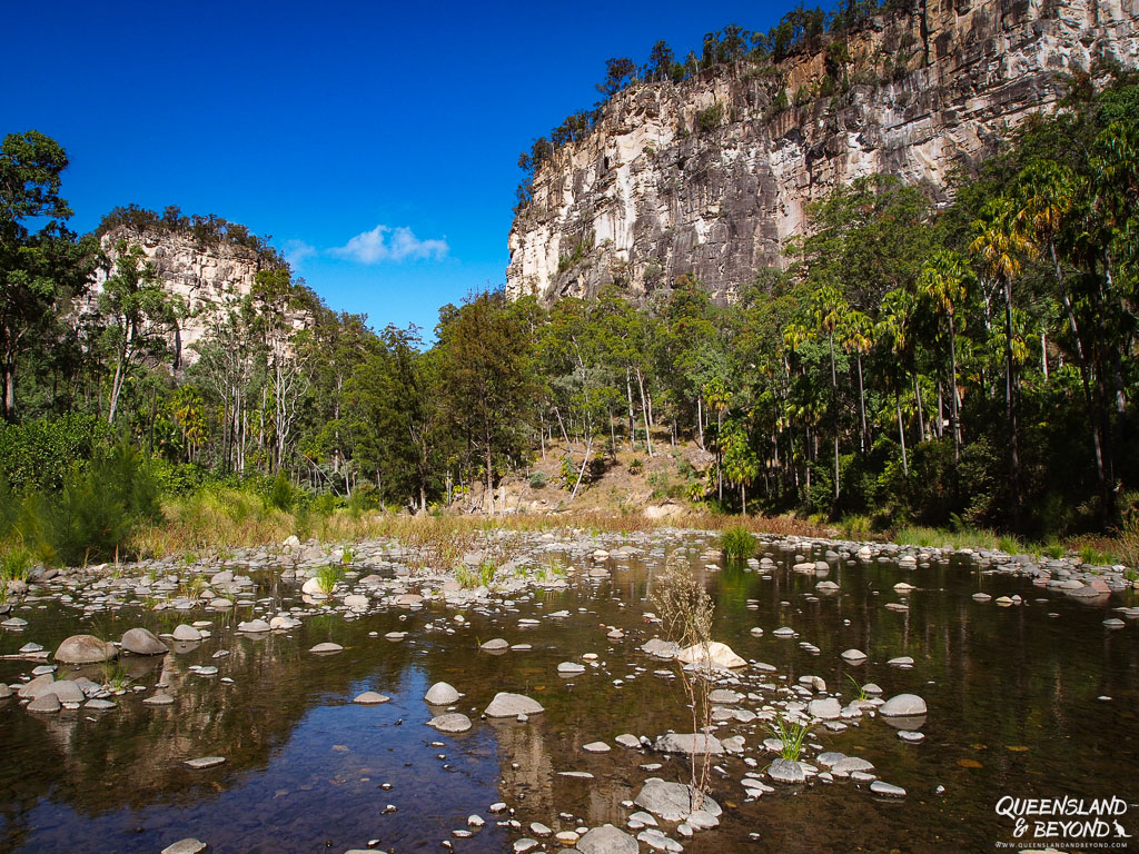
To this day, the hike into Carnarvon Gorge remains one of our best hikes in Australia.
HOW TO GET TO CARNARVON GORGE
Carnarvon Gorge is about 720km west of Brisbane, located between Roma and Emerald on the Carnarvon Highway.
It’s a fair trek from the east coast but utterly worth it. If you’re not averse to hours of driving, you can make it to the gorge within a day but it’ll be a looong day.
The gorge itself is easy to find as it’s well signposted from Carnarvon Highway. Head north from Roma (or south from Emerald) towards Injune along Carnarvon Highway, and turn off west onto Wyseby Road.
This road eventually turns into Carnarvon Gorge Road and ends at the national park visitor area.
BEST TIME TO VISIT CARNARVON GORGE
In a nutshell, do not choose summer.
It will be stinking hot in the gorge, and Carnarvon Creek may also run a bit high(er), making creek crossings more of a challenge. Some summers, they’re even impossible depending on the rainfall we’ve had.
Summer will be the wet season with rain a much more likely occurrence.
Late autumn and winter is best. Any time from May to September would be fantastic with temperatures usually heating up a bit more by September.
We always plan our visits for June and July, which tends to be absolutely perfect as the days are warm, sunny and dry (around 25-27°C). The nights, however, can get a bit cold so be prepared for drops in temperature down to 0°C.
HOW MUCH TIME TO PLAN FOR YOUR VISIT
At a minimum, plan to have at least 2-3 days at Carnarvon Gorge to experience all that this spectacular part of Queensland has to offer.
Three days will allow you to explore everything the gorge has to offer while also having a bit of downtime at your campsite. Anything longer than three day will give you space to relax and take things more leisurely.
Less than three days will mean you’ll have to miss out on some tracks or hike much faster and spend less time at each side attraction.
There are a few options to tackling the gorge and the various walking trails.
You can either do an overnight hike into the gorge and explore all the side trips along the way, or you could do day walks, divvy up the side attractions and spread them out over a couple or more days.
We’ve done both, and have hiked into the gorge and camped at Big Bend for a night but have also hiked in and out in a day. If you opt to stay at Big Bend overnight, you’ll have parts of the gorge all to yourself in the morning, which is amazing.
STAYING AT CARNARVON GORGE
No doubt, camping is the most popular option when visiting Carnarvon Gorge. I feel though that you don’t come to Carnarvon Gorge for the camping, you come for exploring the gorge so don’t expect too much from the campsites.
During school holidays (except for the summer ones), you can camp directly in the national park. At other times, you’ve got the choice of the Big4 Breeze Resort (previously Takarakka Bush Resort) or Sandstone Park.
The Big4 Breeze Resort also offers cabins and safari tents if camping isn’t exactly your thing.

Another option is to hike part of the Carnarvon Great Walk and go as far as Big Bend Camping Area.
The Big Bend campsite is walk-in only, and the first camping spot for anyone doing the Carnarvon Great Walk (5-7 days). The campsite is very basic with only a drop toilet but you don’t really need much for an overnight hike anyway. If you choose do this option, you’ll need to pre-book your camping permit.
For a bit more luxury, you could stay at the Carnarvon Gorge Wilderness Lodge.
HIKING TIPS FOR EXPLORING CARNARVON GORGE
Here are a few tips and tricks that have helped us make the most of our Carnarvon Gorge adventures.
DECIDE HOW MUCH TIME YOU HAVE
How much time do you have and what’s most important to you? To walk to the end of Carnarvon Gorge? To see some of the side attractions? To climb onto the bluff and look into the gorge? To do some short trails in and outside the gorge?
Most people walk as far as the Art Gallery (10.8km return + side trips) in a day. You could then spend another day going straight to Boowinda Gorge or Big Bend (19.4km return) and back out again.
If you have more time and energy, climb up to Boolimba Bluff and/or do some of the shorter walks outside the main gorge, e.g. Warrumbah Creek Gorge.
BE PREPARED
If you decide to walk the entire length of the gorge, be prepared for a long day hike, including having snacks/lunch and sufficient water. It’s a 20km hike and 0.5L is not enough water (I have seen this). Don’t forget sunscreen, a hat, etc. on warmer/hot days.
There’s a toilet at the Moss Garden turnoff and then another one at Big Bend (though that’s currently closed).
START EARLY
I also suggest starting early as the gorge is beautiful in the early hours of the morning. The sun creeps slowly into the gorge, casting it in amazing soft light and the birds will sing their little hearts out.
By lunchtime the sandstone is bright and the lushness of the ferns and trees seems pale in comparison.
CREEK CROSSINGS
Since Carnarvon Creek sneaks its way through the gorge, be ready for plenty of creek crossings. There are about 18 crossings if you hike all the way to Big Bend. You will likely have to hop from rock to rock, and depending on water levels you may need to take off your shoes.
Hiking poles will help if you’re a bit unsteady on your feet.
Some of the side tracks also have creek crossings with yet more rock hopping involved.


On our first trip, I managed to not get wet on the way to Big Bend but didn’t juggle my balance quite so well on the way back. Thank goodness it was a nice, warm day and my feet were boiling in my hiking boots anyway.
USEFUL GEAR FOR HIKING CARNARVON GORGE
Here are a few things I’ve found useful when exploring Carnarvon Gorge:
- Map: Other than the QPWS map, you don’t really need a map if you stay on the main track and don’t head much further than Big Bend. Carnarvon Gorge is extremely well-signposted, including distance markers.
- Sun protection: Even in winter, the sun can still be strong out here. Don’t forget to take a hat and sunnies, and protect yourself with long sleeves (depending on the weather and UV).
- Foot wear: You don’t really need hiking boots for Carnarvon Gorge (though I have also worn boots). Good quality walking shoes are usually sufficient, including trail runners. I currently wear Merrell Moab 3 hiking shoes and find them very comfortable (I have narrow feet but the Merrell Moab 3 also come in a wide version if you have wider feet). I probably wouldn’t go in thongs though I have also seen that.
- Merino socks: I have been hiking in merino socks for a very long time. I usually wear Icebreaker merino socks and choose my socks depending on thickness and my footwear. For Carnarvon Gorge, I mostly wore ‘hike+ medium’ weight to give me more cushioning for the longer walk.
- Hiking poles: For the most part, the track is wide and well-graded (up to around the Art Gallery side track) and doesn’t necessarily require hiking poles. Hiking poles come in very useful though when you need to get across the many creek crossings (depending on water flow) to give you a bit more balance.
- Water bladder: I prefer to carry a water bladder these days and my 2L Osprey hydration bladder was just sufficient to get to Big Bend. We also carried extra water and electrolytes in a smaller water bottle.
- Compeed blister patches: We didn’t need them but I always have them in my first-aid kit for those just-in-case situations. The patch can get stuck on the woollen socks but they work amazingly!
- Hygiene items: Hand sanitiser for use after the drop toilets, I prefer natural hand sanitiser like Koala Eco. We didn’t need toilet paper this time but I carried a small amount in a ziplock bag.
- Rubbish bag: There are no rubbish bins in Carnarvon Gorge so take a ziplock bag for all your rubbish. Like any national park, Carnarvon Gorge is pack in pack out – take all your rubbish out with you. Follow leave no trace principles to keep the gorge pristine.
CARNARVON GORGE WALKS
There are so many sights to see at Carnarvon Gorge that you’ll need a few days.
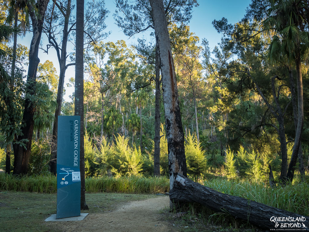
The main attraction is the Main Gorge Walking Track with its various stunning side tracks. There are also a few other short walks like the Warrumbah Creek Gorge Walk or the Nature Walk.
MAIN GORGE WALKING TRACK (19.4KM RETURN + SIDE TRACKS)
The Main Gorge Walking Track starts at the Carnarvon Gorge Visitor Centre. From there, the Big Bend Camping Area is almost 10km into the gorge, and the end of the easily accessible gorge.
There are seven side tracks along the Main Gorge Walking Track that take you to special places. They’re all worth checking out, each one offers something unique and special.
The trail into the gorge basically follows Carnarvon Creek with, as mentioned, plenty of creek crossings along the way.
Initially the track is moderately uphill but then flattens out after the first two kilometres. Some of the side trips also involve a bit of a gradient.

1. BOOLIMBA BLUFF (2.2KM ONE-WAY)
The turnoff for Boolimba Bluff is about one kilometre into the gorge, making this into a 6.4km return hike. This side trip is best tackled separately and not as part of a larger gorge walk (unless, of course, you’re 21 and suffer from an abundant surplus of energy…).
It’s an uphill track, with stairs and ladders involved (elevation gain ~200m) that lead out of the gorge and onto a bluff. At the end, you’ll get expansive views from the bluff over Carnarvon Gorge.


It’s supposed to be great for sunrise with light streaming into the gorge but we went up for sunset as this worked better with our plans.

2. MOSS GARDEN (230M ONE-WAY)
The Moss Garden is the second side track of the Main Gorge Walking Track, and a very quick one. The turnoff is about three kilometres into the gorge.
At the end, you’ll find a gorgeous, icy pool with an intimate, tranquil waterfall, dripping moss and lots of ferns. A beautiful spot.


If you come later in the day, it can be very bright here and not look quite as magical.
If you need toilets, you’ll find some at the turnoff to the Moss Garden.
3. AMPHITHEATRE (630M ONE-WAY)
The Amphitheatre is a 60m deep chamber inside the walls of the gorge. Eerie atmosphere and amazing acoustics! We heard a couple sing in harmony in there once, it sent shivers down my spine it was so glorious. This is a special place.
I loved having to climb the stairs into the narrow gorge to get to the Amphitheatre. That is so cool!
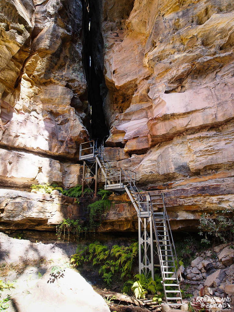


4. WARD’S CANYON (270M ONE-WAY)
From the Amphitheatre, it’s only another 900 metres to the start of the walk to Ward’s Canyon. From the start of the gorge walk, it’s 4.3km to here.
Though a bit of a steep side track, the walk takes you to a beautiful, little gorge where I fell in love with the ochre-reddish water of the little creek running through it.


You’ll also find the beautiful King Ferns here.
5. ART GALLERY (340M ONE-WAY)
From Ward’s Canyon, it’s not far (about 800m) to walk to the next side track. The first time we visited, this was one of the sites I’d been looking forward to the most: Aboriginal rock art at the Art Gallery (Bidjara and Karingbal People).
There are some 2,000 engravings, stencils and free-hand paintings along a 62m sandstone wall. Impressive.
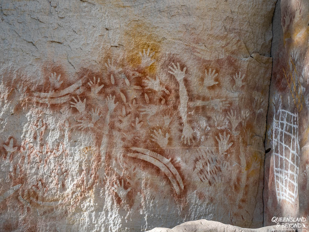

It’s much easier to see the rock art when it’s overcast or early in the morning before the bright sun casts shadows all over the rock face.
The Art Gallery feels like a truly special place. There’s a boardwalk installed so that people are reminded to treat this place with respect.
Most people make it as far as the Art Gallery in a day as it’s about 5.4km (10.8km return) to here from the start of the Main Gorge Walking Track.
If you’re reasonably fit, hiking into the gorge and doing these last four side tracks would be quite doable. Keep in mind that you’ll also want to spend some time at each site so it’s not just a matter of hiking 11km.

From the Art Gallery, the track becomes narrower and is mostly single-file. You’ll have another 4km on your hands before getting to the last side track, and from there to the Big Bend camping area.

6. CATHEDRAL CAVE (15M ONE-WAY)
Cathedral Cave is another stunning Aboriginal rock art site. It’s a massive overhang that allows you to contemplate the art in a panoramic sense.


Once you’ve made it this far, you don’t meet that many people anymore.
On our first hike, it was already late in the afternoon and so we had the entire rock art site to ourselves.
7. BOOWINDA GORGE (~1KM IN TO EXPLORE THE GORGE)
Boowinda Gorge is the last side track along the Main Gorge Walking Track, and only another 80 metres along from Cathedral Cave.
Being 9.2km from the visitor centre means that not as many people explore it so the chances are pretty high that you get to wander through it all by yourself, especially if you’re there in the morning.
This is also where you continue on the Great Carnarvon Walk, a multi-day hike that’s still on our ‘to-hike’ list.
The first kilometre into the gorge is the most spectacular as it’s very narrow and flanked by towering, moss-covered sandstone cliffs. The trek is slow-going though as Boowinda Gorge is rocky ground, and you’re basically rock and boulder-hopping the entire time. This becomes pretty tiring after a while. Walking on a dirt track afterwards never felt so good!
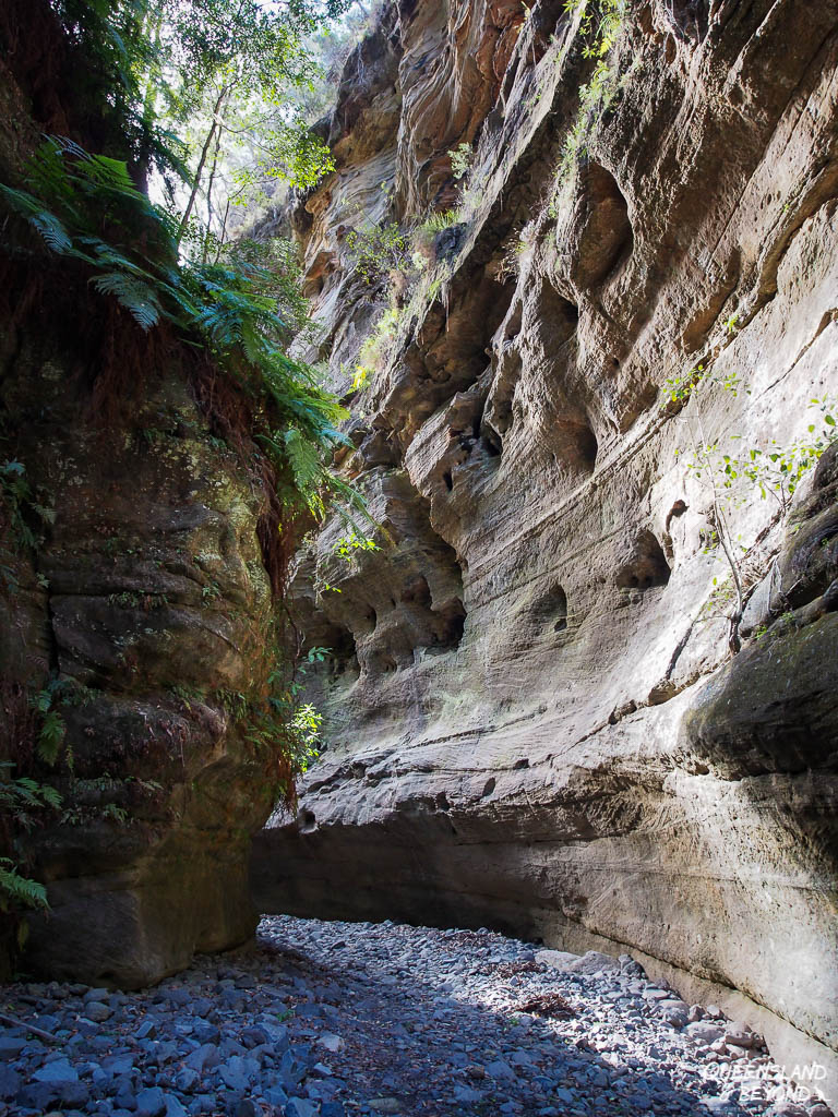


If you’re up for it, I highly recommend the climb out of the gorge as you’ll be rewarded with sprawling views over Carnarvon National Park. The climb out of Boowinda Gorge onto the escarpment is on an unformed track that’s steep and potentially slippery.
We’d dumped our packs (after staying the night at Big Bend) at the start of Boowinda Gorge, and I was very happy not to have to carry it out of the gorge as my balance would have been all over the place otherwise.
EXTENSION: BATTLESHIP SPUR
Battleship Spur is a lookout back towards Carnarvon Gorge that we were quite keen to see.
However, we never made it to Battleship Spur in the end, mostly because we had basically no information beyond “climb out of Boowinda Gorge”. Other information ran to the tune of “It’s half hour from the start of Boowinda Gorge, I think??” or “No, it’s an hour and half, maybe??” or “No, it’s half hour once you’ve scrambled out of the gorge!”.
To reach Battleship Spur, you hike through Boowinda Gorge for about 1km. Keep a lookout for an orange marker on your right where you’ll follow a very narrow, steep track out of the gorge. This is more of a rock scramble than a track so don’t expect anything fully formed.


Once you’re out of the gorge, a semi-formed track picks up again and you’ll just follow along until you hit a turnoff. Watch for orange markers to help you navigate, the track here is very small and can become indistinguishable.
At the turnoff, the left one will take you further along the Great Carnarvon Walk while the track on the right goes out to Battleship Spur. Eventually.
We probably walked for a good hour or so once we’d climbed out of Boowinda Gorge but as the track is entirely uphill, we decided to turn around at some point since we had no idea whether we’d missed a turnoff or what.
In hindsight, we know that we got pretty close to it and should have kept going until the path forked to the left and right. At the time, we just couldn’t tell as there’s no distance indicated anywhere and you’re walking through relatively dense vegetation.
Having a topographic map for the Great Walk would obviously have helped us enormously.

Regardless whether you’ll make it to Battleship Spur or not, you’ll be able to enjoy some magnificent views over the escarpment and gorge.
8. BIG BEND
From Boowinda Gorge it’s not far to Big Bend (420m).

As I mentioned, camping at Big Bend is pretty basic but when you arrive late in the afternoon and set off again early morning, it doesn’t really matter.


One last impression from Big Bend though… I found these amazing orange fungi things on a fallen tree trunk. As I was crouching on the tree trunk trying to get nice and close to the fungi, I was totally oblivious to other creatures in my purview.

Only found this little friend afterwards when I was looking through my photos, haha!
OTHER WALKING TRAILS AT CARNARVON GORGE
Beyond the Main Gorge Walking Track, there are a couple of other trails you could hit.
Sadly, the track to Baloon Cave remains closed after the boardwalk caught fire and destroyed much of the rock art there in 2020. But here’s a quick overview of the hiking trails you could do.
1. NATURE TRAIL (1.5KM CIRCUIT)
The trail starts at the visitor centre and loops back around Carnarvon Creek for an easy stroll. It’s not particularly amazing but we’ve used it as an alternative end to coming out of the gorge.
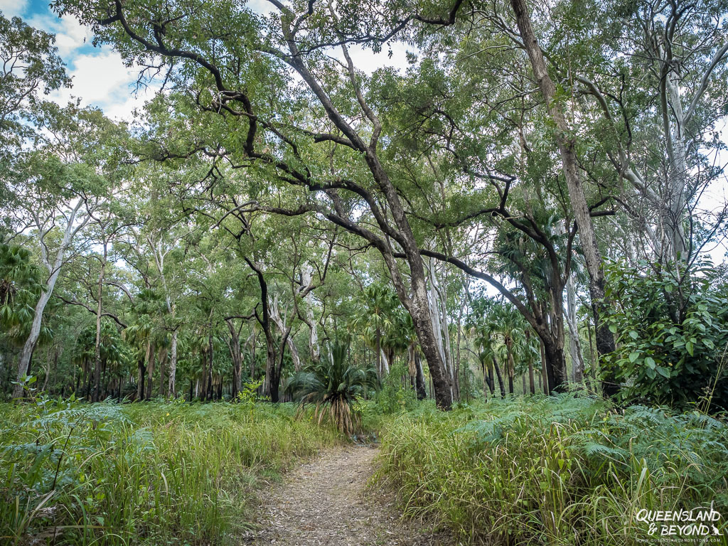
2. MICKEY CREEK (3KM RETURN)
The trail starts at the Mickey Creek car park and takes you into Mickey Creek Gorge. It’s a fairly easy stroll but Mickey Creek isn’t all that exciting even if you scramble past the formed track.
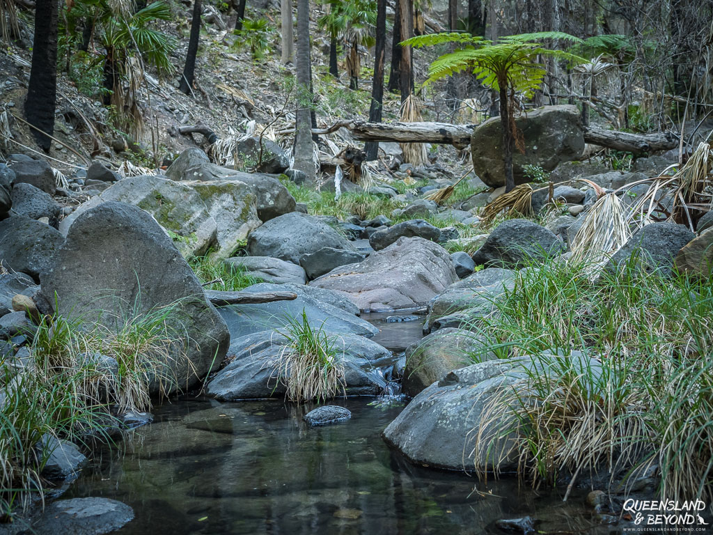
3. WARRUMBAH CREEK GORGE (3.4KM RETURN)
The walk to Warrumbah Creek Gorge also starts at the Mickey Creek car park and follows the same trail for much of it. It branches off to the right just before you get to Mickey Creek.
The formed track ends soon after the turnoff but keep going past the sign, it gets interesting from there. You can climb down the gorge for a fair bit, if you’re not too claustrophobic or there isn’t too much debris from floods.
We followed the gorge for ages, jumping across puddles and climbing up logs, until we found ourselves at a deep rock pool and turned around.


4. ROCK POOL (0.4KM RETURN)
This is a very quick track starting at the Rock Pool car park to a small rock pool area. It’s not very long and not very spectacular (once you’ve seen the main gorge). Kids often like it for a shallow swim though.
You could also walk from the visitor centre / camping area along Carnarvon Creek, which might make this walk much more interesting (3.6km return).
FINAL THOUGHTS
Carnarvon Gorge is an amazing part of the much larger Carnarvon National Park.
It’s a long way so plan a few days to explore all the walks, have time for a picnic or just to watch some birds and wildlife around Carnarvon Creek.
The Aboriginal history and cultural artefacts here are fascinating with fantastic examples of indigenous rock art.
Hiking into the gorge and camping at Big Bend is definitely an experience, and even though we haven’t yet made it to Battleship Spur, I’d recommend the climb out of the Boowinda Gorge to anyone who feels they’ve got the energy to do so.
If you’re not keen to carry camping gear into the gorge, spend 2-3 days doing hikes in and out, and you’ll still have a brilliant time!
Happy exploring,

MORE INFORMATION
For details on what to expect at Carnarvon Gorge, walking tracks, how to get there, etc., check out Queensland Parks & Wildlife Service. Or download the Queensland Park’s Carnarvon Gorge Guide (PDF), which includes a map of the area.
If you’re not sure about the various camping options at Carnarvon Gorge, read my essential camping guide to Carnarvon Gorge.
MORE POSTS ON EXPLORING CARNARVON NATIONAL PARK
I’ve written a few posts on the various sections of Carnarvon National Park so if you’re as excited as I am about this part of Queensland, you may want to check them out.
- Complete Guide to Exploring Mount Moffatt
- Guide to Camping at Mount Moffatt
- Essential Carnarvon Gorge Camping Guide
- Guide to Exploring Salvator Rosa
SAVE TO PINTEREST



8 Comments
Graham
1 June 2020 at 5:36 AMAs time goes by, I hope I can check out all your photos, do you use any special filters? Can’t find your recent more personal post at the moment, so I’ll mention here, is there something particular about Queensland? Diane Cilento ran Beshara courses back in the eighties I think at her place near Cairns, and there is a White Eagle Temple near Maleny. Perhaps neither of them is your cup of tea though. Regards Graham.
Kati
9 August 2020 at 1:45 PMHi Graham,
I just realised that I never responded to your comment, sorry!
Re. your question about filters – yes, I have a UV filter for each lens (that I don’t take off), and often use a polarising filter. I also have two neutral density (ND) filters that I use on occasion for waterfalls and flowing water, and sometimes also to block out light when it’s really bright (but not usually).
Re. your question about Queensland – no, there’s nothing that special about Queensland, only that we moved here a few years ago. And at the moment, we’re stuck here as well. 🙂
And the White Eagle Temple isn’t probably not my cup, you’re quite right. 🙂
Graham
24 December 2021 at 10:35 PMAnd I never thanked you for the reply. I have a nephew who’s work involves cameras, so one day, when we’re living more in harmony with Covid-19, I’ll ask him. Cases of Omicron rising no matter which hemisphere or season we are in, wishing you well and Happy Christmas.
Stephen Eddey
5 August 2021 at 4:04 PMI love your posts and pics. It is really helping me plan trips. Thank you for taking the time to do these.
Kati
7 August 2021 at 9:26 AMHi Stephen,
Thanks for your feedback, that’s really great to hear. Comments like yours make it worthwhile spending all this time writing these. 🙂
mdtaylor
12 October 2021 at 12:23 PMI was interested to read your article. I have been to carnarvon many times. One walk/scramble which is never mentioned is the track up to Devil”s Signpost. Vey steep and roughbut easily done for someone sound of limb
M D taylor
Peter J
13 June 2022 at 3:11 PMHi Kati,
Thank you soooo much for such a comprehensive guide. A friend and I are going in August (2022) when we hope to have really fine weather.
I think your photos are amazing and they have really captured the mood of the place. Can you please tell me which time of year they were taken?
Warm regards
Peter
Kati
18 July 2022 at 4:46 PMHi Peter,
This is one of the loveliest comments I’ve ever received, thank you for your warm words! 🙂
We’ve been to Carnarvon Gorge twice, three times ? (I forget now… 🙂 ) and it’s always been in the middle of winter (June-ish). A couple of years ago it was almost July, I think, or right at the end of June. August will still be lovely, especially with all the rain we’ve had. The creek should still be flowing nicely. My one recommendation would be to start your walk early – the gorge is at its best in the early morning (in my opinion). You’ll hear the birds and will see the light starting to creep into the gorge and the sandstone will look warm and soft. The water in the creek will be still and you’ll get beautiful reflections.
The gorge is wonderful at any time but it really sparkles in the early hours.
Enjoy your trip, I’m sure you’ll absolutely love it! 🙂